
Local time Thursday 9:21 AM | Province Liège Postal codes 4910 Postal code 4910 | |
 | ||
Weather 14°C, Wind S at 16 km/h, 68% Humidity Points of interest Forestia, Franchimont Castle, Survival Life, Hoëgne | ||
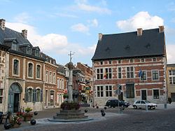
Theux is a Walloon municipality of Belgium in Province of Liège. On 1 January 2006 the municipality had 11,571 inhabitants. The total area is 83.36 km², giving a population density of 139 inhabitants per km².
Contents
Map of Theux, Belgium
The municipality consists of the following sub-municipalities: Theux proper, La Reid, and Polleur.
History
In World War II, the 75th Division of the U.S. Army, 575th Signal Co., maintained its command post in the town from January 10–12, 1945, as it counterattacked against the German army in the Battle of the Bulge.
Notable buildings
References
Theux Wikipedia(Text) CC BY-SA