
Population 860 (2006 census) Postal code 2655 | Postcode(s) 2655 Elevation 236 m Local time Sunday 5:57 AM | |
 | ||
Weather 17°C, Wind E at 8 km/h, 83% Humidity | ||
The Rock is a town with a population of 860, in the Riverina region of southern New South Wales, Australia, in Lockhart Shire. It is 32 kilometres (20 mi) south-west of Wagga Wagga on the Olympic Highway.
Contents
Map of The Rock NSW 2655, Australia
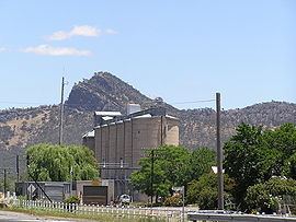
The town is named after the large rocky hill overlooking the town, now called The Rock Hill but called Yerong in the local indigenous language. The reserve that includes The Rock Hill is an attraction in the area for bush-walking, rock-climbing, and observation of wildlife. It is also an Aboriginal sacred site, called Kengal.
History
The Rock Post Office opened on 1 September 1890.
Transport
It is a railway junction town, being the junction point of the Boree Creek line from the Main South line. It is served twice daily by the XPT to Melbourne, and twice daily by the XPT to Sydney.