
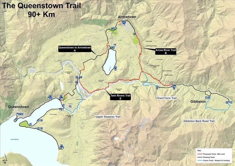
Highest point 425m near Arrowtown | Length 110,000 m | |
 | ||
Location Queenstown, New Zealand Trailheads Queenstown / Arrowtown / Gibbston / Jack's Point Use Walking
Running
Cycling Lowest point 300m at Frankton Arm beach Trail difficulty Easy / Intermediate / Advanced (depending on track) | ||
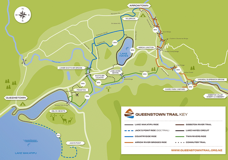
The Queenstown Trail or Queenstown Trail is a cycle and walking trail funded as one of the projects of the New Zealand Cycle Trail (NZCT) system in Otago, New Zealand. It links the towns of Queenstown, Arrowtown and the area of Gibbston. It is at least 110 km in length but is not linear and instead follows the terrain often near rivers and lakes to link key places in a series of tracks that also access public land. In some places it also passes through private land such as working farms and users are encouraged to stay on the trail. The trail is a joint venture between the Government, Queenstown Lakes District Council and the Queenstown Trails Trust.
Contents
- Routes
- Queenstown Bay to Kelvin Heights
- Kelvin Heights to Jacks Point
- Queenstown Bay to Arrowtown
- Lake Hayes Circuit
- Twin Rivers Ride
- Arrow River Bridges Ride
- Gibbston River Trail
- History
- Opening
- Hazards
- Structures
- Existing structures
- New structures
- References

Routes
Popular routes are listed below and can be started and finished in either direction:
Queenstown Bay to Kelvin Heights
Kelvin Heights to Jack's Point
Queenstown Bay to Arrowtown
Lake Hayes Circuit

Twin Rivers Ride
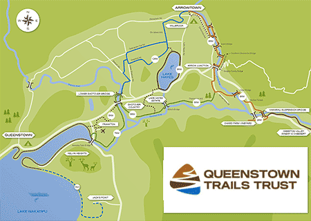
Arrow River Bridges Ride
This route connects Arrowtown to Gibbston. For much of its length follows the Arrow River. It can end at Chard Farm or can be linked onto the Gibbston River Trail. This trail contains many of the bridges that can be passed over on the Queenstown Trail as well as The Barfoot Tunnel.Gibbston River Trail
A route that passes along the Kawarau River around many vineyards in the Gibbston Valley. Carparks are available at each end of the track. There are also several loops in the track allowing for a varied or shorter route. This track was managed by Department of Conservation track until its upgrade in 2014 making it bike friendly and becoming officially part of the Queenstown Trail.
History
Originally the name for the network of trails in the region was the Wakatipu Trails before being renamed The Queenstown Trail. Signage on the trail simply calls it Queenstown Trail. The Wakatipu Trails Trust was set up in 2002 after a meeting between Duncan Field of QLDC and Chris Eden the DOC Wakatipu Area Manager at the time to assess the interest in created a network of recreational trails. In 2004 the Wakatipu Trails strategy was developed which helped to guide the development of the trails. The main routes of the Queenstown Trail now link up with many smaller tracks not part of the official trail many of which existed before its 2012 opening.
Opening
The trail was opened on 18 October 2012 although many parts of the trail had already been constructed and were in regular use by the public before this date. It was officially opened by the Prime Minister John Key and cyclist Sarah Ulmer near Arrowtown. It had taken 3 years and more than 100 contractors costing $5.4 million (NZD) to build.
Hazards
Several places of the trail have drop offs sometimes near rivers, occasionally bad weather can cause slips to occur which can temporarily close parts of the track. Although nearly the entire track is off-road a small number of sections cross either roads or driveways. There is also the potential for collisions between different users since they are travelling at different speeds and directions and there are quite a few blind corners.
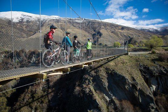
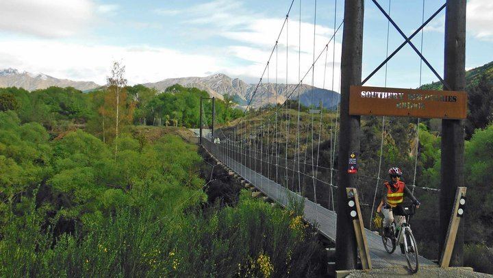
Structures
As part of the Queenstown Trail there are three existing bridges (built before the trail was conceived) and six new structures (two wooden bridges, two suspension bridges, an underbridge and a tunnel). The bridges and tunnel built specifically for the Queenstown Trail were named after families that made significant donations towards the project.