
Province Ulster | ||
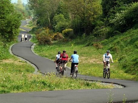 | ||
The Comber Greenway is a 7-mile (11 km) traffic-free section of the National Cycle Network, in development along the old Belfast-Comber railway line. The cycle path starts on Dee Street in Belfast and finishes at Comber. Now completed the Greenway provides an eco-friendly cycle path with views of Stormont and Scrabo Tower. The most recent addition to the route was in November 2008 when the final link between Old Dundonald Road/Comber Rd junction and Comber was opened. This added 2.5 km (1.6 mi) to the route. One section runs through a SLNCI-designated Wetland ecosystem.
Contents
Map of Comber Greenway, United Kingdom
Route
The traffic free route begins at Dee Street in East Belfast and passes by the C. S. Lewis statue at the Holywood Arches, along the Bloomfield Walkway to Sandown Road where it continues past the PSNI headquarters to a newly installed toucan crossing at the Knock Road.
From here it travels up to the Kings Road, where the Kings Road Scooter Club hail from, and onwards to Abbey Road, through Tullycarnet and Ardcarn to East Link Road in Dundonald.
It continues through a wetland area emerging at the Comber Road, Dundonald where a toucan crossing has been installed.
The route continues from Comber Road, Dundonald past the Billy Neill Centre for Soccer Excellence where the former railway line runs near to the Enler River. Walkers and cyclists can cross the River Enler and farm lanes using a series of reinstated bridges before reaching the final destination at the Belfast Road, Comber.
On the way out of Belfast, the Greenway goes through many of the old Belfast and County Down Railway stations i.e. Bloomfield, Neill's Hill, Knock, Dundonald before finishing just short of Comber station.
History
The current route of the Greenway was originally used as the route for the Belfast and County Down Railway. The railway was in use from 1850's to 1950 when it was permanently retired. Throughout the 1950s the track was lifted in stages and infrastructure, including bridges, removed. The remains of Neill's Hill station can still be seen near Sandown Road behind Clara Park and Sandhill Gardens.
In 1964 it was proposed that a section of what is now the Greenway be utilised for the M7 Motorway project. However, this motorway was not constructed. A proposal for a smaller-scale road along the same route was contained in the Belfast Urban Area Plan 2001, but it was also never built.
By late in the century the Greenway had become a recreation path for walkers, cyclists etc. In 2003/4 the Knock Valley Relief Sewer was installed from Ballymacarett to Dundonald resulting in substantial excavation along the path. Subsequently, a number of government agencies contributed funds to upgrade the Greenway with a modern hard surface, road crossings and, with the opening of the section alongside Police Headquarters, a continuous route from inner Belfast to Comber. It was officially opened on 8 November 2008.
Threat
As part of the Belfast Metropolitan Transport Plan 2015 published in November 2004, a rapid transport scheme was proposed for three routes in Belfast. The route to the east of the city, dubbed EWAY, proposed utilising the Greenway for either a light rail or bus link for Belfast.
Atkins KPMG subsequently completed a preliminary assessment of the proposals. Key conclusions include the preference for bus over light rail on cost grounds and the construction of much of the route along the Greeenway.
Political support is behind the rapid transport concept although the EWAY route is contentious. An active campaign group has formed to protect the Greenway calling for relocation of the EWAY route onto the Upper Newtownards Road and increased public consultation. [1]
An announcement by the BBC confirmed that the EWAY will not be using the The Comber Greenway as part of its route.