
Country Thailand Time zone THA (UTC+7) Area 272.2 km² Province Yasothon Province | Seat Thai Charoen Postal code 35120 Population 29,842 (2005) Geocode 3509 | |
 | ||
Thai Charoen (Thai: ไทยเจริญ, [tʰāj t͡ɕā.rɤ̄ːn]) is a district of Yasothon Province in northeastern Thailand.
Contents
- Map of Thai Charoen District Yasothon Thailand
- History
- Geography
- Primary occupations
- Important products
- Administration
- District office
- District officers
- Education
- References
Map of Thai Charoen District, Yasothon, Thailand
History
Thai Charoen, formerly a subdistrict (tambon) of Loeng Nok Tha, was established as a minor district (king amphoe) on April 1, 1992, comprising 5 subdistricts formerly of Loeng Nok Tha.
On October 11, 1997, Thai Charoen was raised to district (amphoe) status, becoming Yasothon's 9th and Thailand's 784th district.
The area has been home to the Roman Catholic St Michael's Church, Songyae, since AD 1908.
Geography
Neighboring districts are (from the south clockwise) Pa Tio, Kut Chum, Loeng Nok Tha, of Yasothon Province, Senangkhanikhom and Mueang Amnat Charoen of Amnat Charoen Province.
Primary occupations
Important products
Administration
The district is subdivided into 5 subdistricts (tambon), which comprise 48 villages (muban).
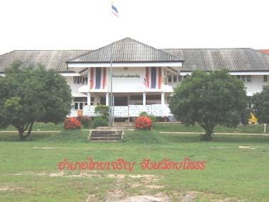
District office
The Thai Charoen District Office is located at:
Khamtoei-Nakham Road
T. Thai Charoen
A. Thai Charoen
Yasothon 35120
District officers
The district officers (nai amphoe) of Thai Charoen:
- Mr. Nirat Ratna (นายนิราศ รัตนะ) November 17, 1997 – November 19, 1999
- Mr. Narong Sombunsut (นายณรงค์ สมบูรณ์สุทธิ์) November 29, 1999 – October 5, 2003
- Mr. Wichak Chinkhotphong (นายวิจักขณ์ ชินโคตพงษ์) October 6, 2003 – October 31, 2004
- Mr. Buntham Loetsukhikasem (นายบุญธรรม เลิศสุขีเกษม) November 1, 2004 – Present
Education
The secondary schools in Amphoe Thai Charoen are: