Country Thailand Tambon 7 Time zone THA (UTC+7) Area 1,681 km² Province Uttaradit Province | Seat Tha Pla Muban 76 Postal code 53150 Population 44,025 (2014) Geocode 5303 | |
 | ||
Tha Pla (Thai: ท่าปลา; [tʰâː plāː]) is an Amphoe (district) of Uttaradit Province, in northern Thailand.
Contents
- Map of Tha Pla District Uttaradit Thailand
- History
- Geography
- Central administration
- Local administration
- References
Map of Tha Pla District, Uttaradit, Thailand
History
The district Tha Pla was originally part of Nan Province until it was reassigned in 1923 to Uttaradit Province.
Geography
Neighboring districts are (from the east in a clockwise order): Nam Pat, Thong Saen Khan and Mueang Uttaradit of Uttaradit Province, Den Chai, Sung Men and Mueang Phrae of Phrae Province, and Na Muen of Nan Province.
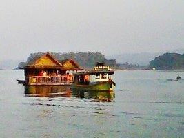
The main river of the district is the Nan River, with the Sirikit Dam creating a 250 km² artificial lake. The Pat River joins the Nan shortly below the dam.
Central administration
The district Tha Pla is subdivided into 7 subdistricts (Tambon), which are further subdivided into 76 administrative villages (Muban).
Number 6 belonged to the subdistrict Tha Faek reassigned to Nam Pat district in 2015.
Local administration
There are 3 subdistrict municipalities (Thesaban Tambon) in the district:
There are 6 subdistrict administrative organizations (SAO) in the district:
