
Country Thailand Postal code 65000 Website ThaiTambon.com Province Phitsanulok Province University Naresuan University | Time zone Thailand (UTC+7) Chief watercourse Nan River Population 9,626 (2005) Geocode 650106 | |
 | ||
Amphoes Phitsanulok Province, Mueang Phitsanulok District | ||
Tha Pho (Thai: ท่าโพธิ์) is a subdistrict in the Mueang Phitsanulok District of Phitsanulok Province, Thailand.
Contents
- Map of Tha Pho Mueang Phitsanulok District Phitsanulok Thailand
- Geography
- Administration
- Economy
- Naresuan University
- Primary schools
- Kindergartens
- Hospitals
- Temples
- References
Map of Tha Pho, Mueang Phitsanulok District, Phitsanulok, Thailand
Geography
The topology of Tha Pho is flat lowlands. The subdistrict is bordered to the north by Tha Thong, to the east by Bueng Phra, to the south by Wat Phrik and to the west by Amphoe Bang Rakam. Tha Pho lies within the Nan Basin, which is part of the Chao Phraya Watershed. The Nan River flows through the subdistrict.
Administration
The following is a list of the subdistrict's muban, which roughly correspond to the villages:
Economy
The economy is based on rice farming and other agriculture.
Naresuan University
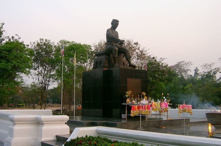
Naresuan University (abbreviated as Mor Nor for Mahawithayalai Naresuan) is located in Tha Pho. The university is named after King Naresuan the Great, and the campus contains a large statue of him.
Primary schools
The following is a list of primary schools in Tha Pho:
Kindergartens
The following is a list of kindergartens (nursing care) in Tha Pho: