
Country Thailand Time zone THA (UTC+7) Area 197.2 km² Province Satun Province | Seat Tha Phae Postal code 91150 Population 24,991 (2005) Geocode 9104 | |
 | ||
Tha Phae (Thai: ท่าแพ) is a district (Amphoe) of Satun Province, southern Thailand.
Contents
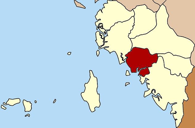
Map of Tha Phae District, Satun, Thailand
History
The minor district (King Amphoe) Tha Phae was established on May 1, 1976 with the two southwestern tambon Tha Phae and Pae Ra of the district Khuan Kalong. It was upgraded to a full district on July 4, 1994.
Geography
Neighboring districts are (from the northwest clockwise) La-ngu, Khuan Kalong, Khuan Don and Mueang Satun. To the southwest is the Andaman Sea.
Administration
The district is subdivided into 4 subdistricts (tambon), which are further subdivided into 28 villages (muban). There are no municipal (thesaban) areas, and 4 Tambon administrative organizations (TAO).
References
Tha Phae District Wikipedia(Text) CC BY-SA