
Country Netherlands Elevation 0 m (0 ft) Area code 0252, 071 Local time Thursday 9:36 AM Clubs and Teams Ter Leede, VV Foreholte | Established 1 January 2006 Time zone CET (UTC+1) Area 33.63 km² | |
 | ||
Postcode 2170–2172, 2215, 2360–2362 Weather 14°C, Wind S at 19 km/h, 73% Humidity Points of interest Kagerplassen, Teylingen Castle, Ruïne van Teylingen, De Bollenburcht, Museum Sikkens Schildersmuseum | ||
Teylingen ( [ˈtɛilɪŋə(n)]) is a municipality in the western Netherlands, in the province of South Holland. It was created on 1 January 2006, through the amalgamation of Sassenheim, Voorhout, and Warmond. It is named after Castle Teylingen, located in Voorhout.
Contents
Map of Teylingen, Netherlands
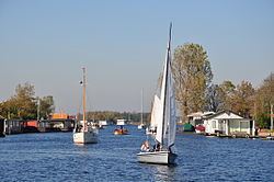
The municipality is bordered by Noordwijkerhout and Lisse to the north, Haarlemmermeer and Alkemade to the east, Leiderdorp and Leiden to the south, and Oegstgeest and Katwijk to the west. It is located in an area called the "Dune and Bulb Region" (Duin- en Bollenstreek). The Kagerplassen are to the east of Sassenheim.
References
Teylingen Wikipedia(Text) CC BY-SA