
Existed: 1974 – present Counties: Hansford Length 9.267 km | SH 143 SH 144 → Constructed 1974 | |
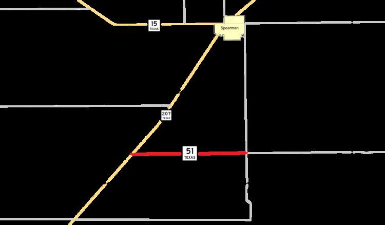 | ||
East end: FM 281 / FM 760 south of Spearman | ||
Texas State Highway 51 (SH 51) is a short state highway located entirely in Hansford County, Texas, just south of Spearman.
Contents
Map of TX-51, Spearman, TX 79081, USA
Route description
SH 51 begins at SH 207 southeast of Spearman and travels east through unincorporated Hansford County approximately 5.7 miles (9.2 km). It is a two-lane route for its entire length, and has no intersections with other state-maintained routes until its terminus at FM 281, which continues to the east and south, and FM 760, which travels north to Spearman.
History
The original SH 51 was designated by 1926 as a route from Sagerton to Crowell, replacing a portion of SH 28. By 1928, it extended north to the Oklahoma state line. It was canceled by 1932, being replaced by SH 16.
The second SH 51 was designated by 1932 as a route from Dalhart northward to the Oklahoma state line. It was extended south to McCamey by 1935, replacing SH 143 from Channing to Brownfield and the majority of SH 137 from Brownfield to McCamey. In 1942, it extended south to Sheffield. In 1956, the highway was rerouted southwest over FM 1214 from US 290 to US 90 and SH 227 from US 90 to the entrance of Big Bend National Park. The section from Rankin to Sheffield was transferred to SH 349. This entire route was canceled in 1959 when US 385 was transferred to the west.
The current SH 51 was designated in 1974; its routing has remained unchanged.
Major intersections
The entire route is in Hansford County.