
Existed: 1942 – present Length 18.41 km | Constructed 1942 | |
 | ||
North end: US 69 / US 96 / US 287 in Beaumont | ||
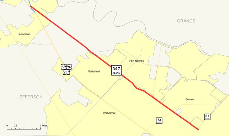
State Highway 347 or SH 347 is a Texas state highway that runs northwest from Port Arthur to the southern edge of Beaumont. The highway is signed south-north. It was designated in 1942.
Contents
Map of TX-347, Texas, USA
Route description
SH 347 begins at SH 87 in Port Arthur. The highway heads northwest, crossing SH 73, Spur 136 and FM 365. SH 347 then enters Nederland and has a junction with FM 366. Continuing northwest, the highway enters Beaumont and ends at US 69/US 96/US 287 in the southern end of the city.
Junction list
The entire route is in Jefferson County.
References
Texas State Highway 347 Wikipedia(Text) CC BY-SA