
Existed: 1939 – present Length 86.43 km | South end: Loop 12 in Dallas Constructed 1939 | |
 | ||
North end: Elks Boulevard near Pottsboro | ||
State Highway 289, known for most of its length as Preston Road, is a north–south Texas state highway. It begins at the intersection of Preston Road and Loop 12/Northwest Highway in Dallas. The Preston Road designation comes from the fact that the highway generally follows the course of an older road known as the Preston Trail, which ran to the town of Preston Bend. Preston Bend is now submerged by Lake Texoma.
Contents
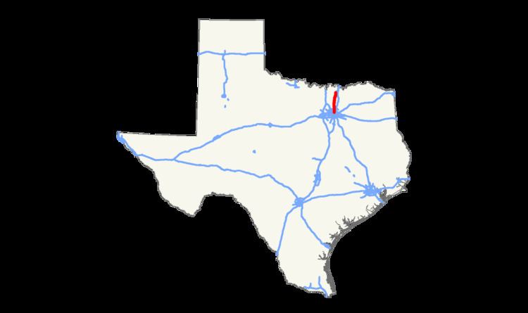
Map of TX-289, Texas, USA
The road is known as Preston all the way north through the remainder of the Dallas-Fort Worth Metroplex to a junction with State Highway 56 west of Sherman, Texas, near the Oklahoma border (except for the portion through Gunter which is designated as 8th Street).
Preston Road passes through many of the fast-growing northern Dallas suburbs, including Frisco and Plano, as well as Prosper and Celina, which have started seeing new housing developments along Preston.
History
By 1939, this route was renumbered from part of SH 14. Prior to 1989, SH 289 began north of downtown Dallas, Texas (USA) in the Oak Lawn neighborhood at an intersection with Pearl Street. From there, the highway designation followed Cedar Springs Road northeast for less than a block, and upon an intersection with Maple Avenue, ran northwest up that street. Less than a mile later at an intersection with Oak Lawn Avenue, the highway designation turned northeast up Oak Lawn, which it followed into Highland Park. There it was known as Oak Lawn Avenue until an intersection with Armstrong Parkway, where it became Preston Road.
Preston Road is one of the most congested highways in the Dallas/Fort Worth Metroplex; however, due to urban growth along the highway there is minimal room to add additional lanes, and no means to upgrade the road to freeway status without incurring significant cost to demolish businesses along the path. Instead, the nearby Dallas North Tollway generally parallels Preston Road.
In 2010 an extension of SH 289 was completed from its previous terminus at SH56 northward to a new connection with Farm to Market Road 120 near Pottsboro, Texas, another segment of the old Preston Trail which ends on the south shore of Lake Texoma. (FM 120 north of the connection has been renamed as State Highway 289, except for a very small segment northeast of the intersection which was renamed as Spur 316.) SH289 officially ends at Elks Boulevard; the actual road continues for another 3–4 miles before ending at a local street in the Preston Bend community.
This provides another access route to North Texas Regional Airport, which has been proposed as a third airport for the DFW area. Approximately US$63 million in bonds were sold by Grayson County, Texas. The Texas Department of Transportation has promised US$85 million in reimbursements for the bonds sold by the county.