
Existed: by 1931 – present | Length 54.6 km | |
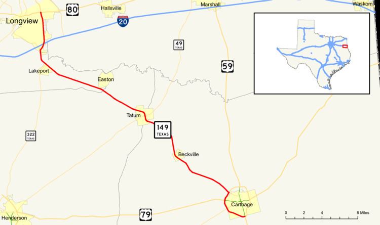 | ||
State Highway 149 or SH 149 is a state highway that runs from Carthage to Longview in east Texas.
Contents
Map of TX-149, Texas, USA
History
SH 149 was originally designated by 1931 along its current route and included an extension north from Longview to Daingerfield. The northern extension was transferred to SH 26 by 1939. In 1988 a loop around Carthage was completed, with SH 149 being routed around the western side of town. The old routing that entered Carthage was re-designated State Spur 572.
Route description
SH 149 begins at an intersection with US Route 259 and US Route 80 in downtown Longview. The route travels southward concurrent with US 259 to an intersection with Interstate 20. SH 149 and US 259 split here, with US 259 traveling west with I-20 and SH 149 continuing south. The route meets State Highway 322 near the East Texas Regional Airport before turning southeast. The routes continues, intersecting SH 43 at Tatum, before continuing on toward Carthage. At Carthage, the routes continues around the western portion of the loop around town, briefly running concurrent with US Route 79, before reaching its southern terminus at US Route 59 (Future Interstate 369) on the south side of town.