
Existed: 1955 – present Constructed 1955 | East end: SH 115 Length 22.16 km | |
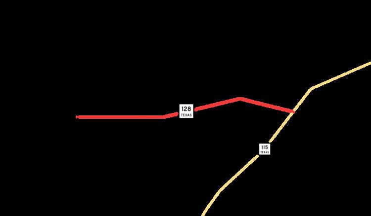 | ||
West end: NM 128 at New Mexico state line near Jal | ||
State Highway 128 (SH 128) is a state highway in Andrews County, Texas.
Contents
Map of TX-128, Andrews, TX 79714, USA
Route description
SH 128 begins at the New Mexico state line east of Jal, New Mexico, as New Mexico Highway 128 crosses into Texas. The route immediately encounters its only intersection between its termini, at FM 1218, which runs just inside the state line. The route travels eastward through unincorporated Andrews County before ending at SH 115 about 20 miles (32 km) southwest of Andrews.
History
SH 128 was originally designated by 1928 along a route from Robstown northeast to Victoria. By 1933, it had been extended west to Alice, replacing a portion of SH 12A. By 1935, it extended north to Hallettsville By 1938, this segment had been renumbered as SH 44.
The current route was originally designated in 1948 as Farm to Market Road 781 and ran from the state line to FM 703. The highway was signed, but not officially designated, concurrently as SH 128 beginning in 1955, "for guidance of traveling public" to correspond with New Mexico State Highway 128. The FM 781 designation was cancelled in 1990; the same year, FM 703 became part of SH 115.
Major intersections
The entire route is in Andrews County.