
- elevation 1,558 m (5,112 ft) Length 256 km Basin area 5,590 km² Country Japan | - elevation 0 m (0 ft) Discharge 233.5 m³/s | |
 | ||
- average 110 m/s (3,885 cu ft/s) Mouth Sea of Japan (also known as East Sea) | ||
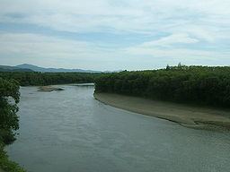
The Teshio River (天塩川, Teshio-gawa) is a river in Hokkaido, Japan. At 256 kilometres (159 mi), it is the fourth longest river in Japan.
Map of Teshio River, Sarakishi, Teshio, Teshio District, Hokkaido Prefecture, Japan
The name of the river derives from an Ainu word meaning "fishing weir."
References
Teshio River Wikipedia(Text) CC BY-SA