
Length 203.9 km | ||
 | ||
Counties Wayne County, Tennessee, Lewis County, Tennessee | ||
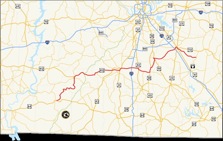
State Route 99 is a long east–west highway in Middle Tennessee. The route travels through large sections of rural areas and for most of the length is a secondary highway. The route begins near Waynesboro and ends in Bradyville after logging 128.4 mi (206.6 km) and passing through six counties.
Contents
Map of TN-99, Tennessee, USA
Route description
The highway begins at an intersection with U.S. Route 64 as a secondary route that was the former route of US 64 in Wayne County. From there it travels through Lewis County where it meets U.S. Route 412. At this point SR-99 is concurrent with US 412 though it is not signed. This remains until US 412 and SR-99 enters Maury County. East of Columbia, SR-99 separates from US 412 at Interstate 65 as US 412 ends. From here SR-99 crosses into Marshall County before entering Rutherford County. In Murfreesboro, SR-99 is unsigned from the intersection with SR-96 to US 70S and US 41. Then SR-99 heads into Cannon County to its terminus.