
Listing Tahoe OGUL Peak List Easiest route Scramble, class 2 Prominence 83 m Parent range Sierra Nevada | Topo map USGS Loon Lake Elevation 2,704 m Mountain range Sierra Nevada | |
 | ||
Similar McConnell Peak, Red Peak, Phipps Peak, Mount Price, Rubicon Peak | ||
Tells peak b 17
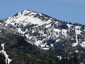
Tells Peak is a mountain in the Sierra Nevada at the very north end of the Crystal Range (California), to the west of Lake Tahoe. It is located in the Desolation Wilderness in El Dorado County, California.
Contents
Map of Tells Peak, California, USA
The origin of the name is not certain. It is probably named for a Swiss homesteader named Tell who lived a few miles to the west. At least one historian believes it was named for Ciperano Pedrini, a storekeeper in Garden Valley, who was known as Bill Tell.
References
Tells Peak Wikipedia(Text) CC BY-SA