
Arabic تلّ الصافي Population 1,290 (1945) | Also spelled Tall al Safi Palestine grid 135/123 Local time Tuesday 9:13 PM | |
 | ||
Name meaning The clear, or bright mound. (Name dates from the 12th century) Weather 14°C, Wind N at 8 km/h, 83% Humidity | ||
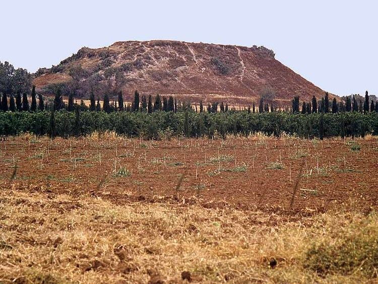
Tell es safi biblical gath aerial views biblewalks com
Tell es-Safi (Arabic: تل الصافي, Tall aṣ-Ṣāfī, "the white hill"; Hebrew: תל צפית, Tel Tzafit) was a Palestinian village, located on the southern banks of Wadi 'Ajjur, 35 kilometers (22 mi) northwest of Hebron that was depopulated during the 1948 Arab-Israeli war on orders of Shimon Avidan, commander of the Givati Brigade.
Contents
- Tell es safi biblical gath aerial views biblewalks com
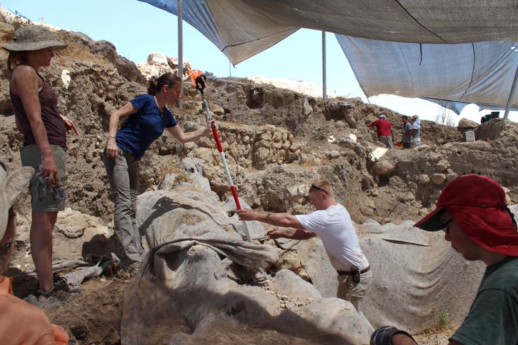
- Science and archaeology at tell es safi gath prof aren maeir
- Location and topography
- History
- Bronze and Iron Ages
- Byzantine period
- Crusader and Ayyubid period
- Mamluk period
- Ottoman era
- British Mandate era
- 1948 and after
- References
Archaeological excavations show that the site was continuously inhabited since the 5th millennium BCE. On the Madaba Map, the name is Saphitha, while the Crusaders called it Blanche Garde. It is mentioned by Arab geographers in the 13th and 16th centuries. Under the Ottoman Empire, it was part of the district of Gaza. In modern times, the houses were built of sun-dried brick. The villagers were Muslim and cultivated cereals and orchards.
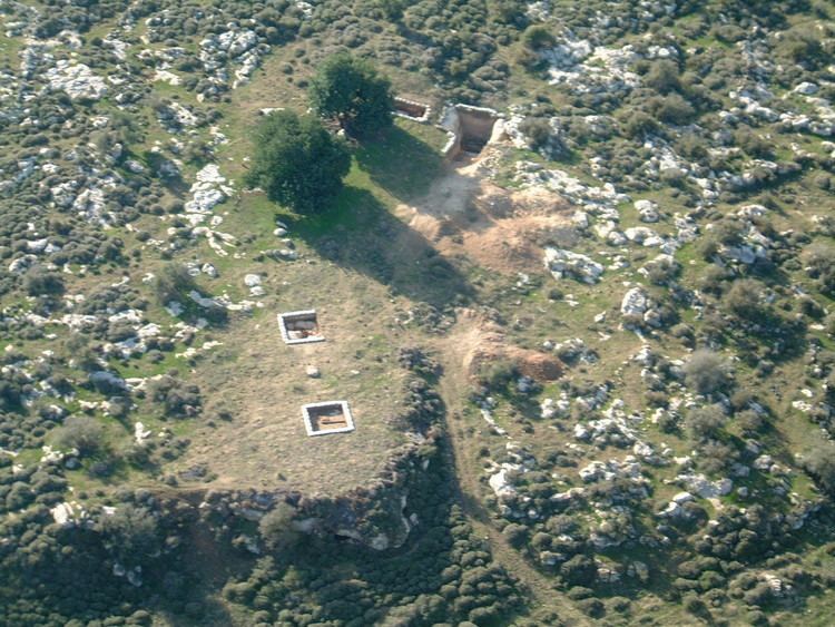
Today Tell es-Safi is an Israeli national park encompassing an archaeological site thought to have been the Philistine city of Gath mentioned in the Bible. The remains of the Crusader fort and the Arab village can also be seen on the tell.
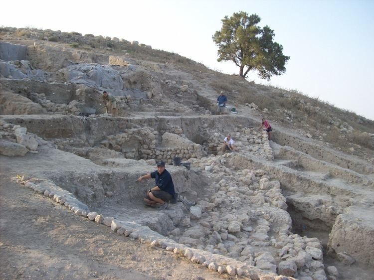
Science and archaeology at tell es safi gath prof aren maeir
Location and topography
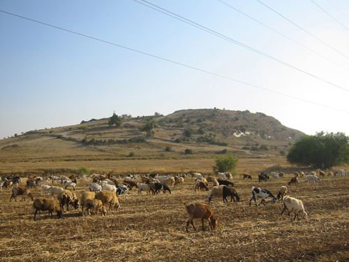
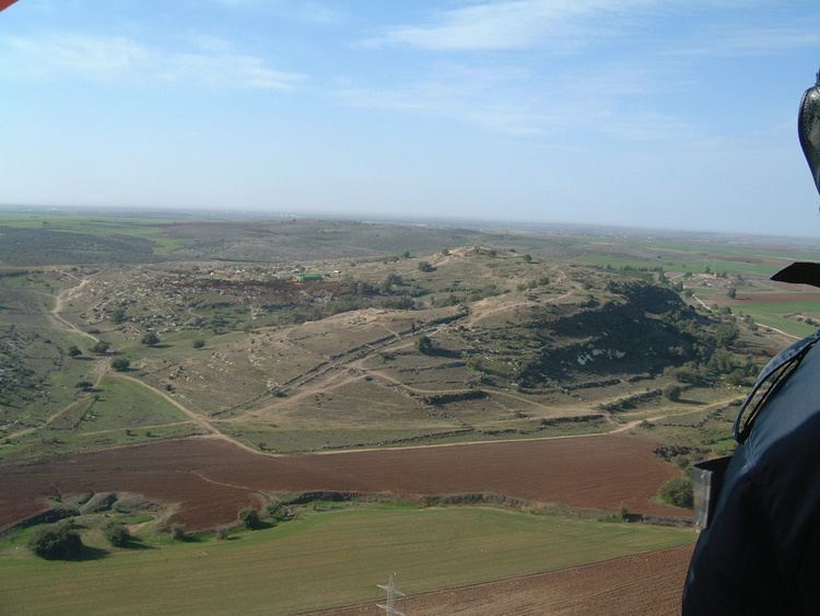
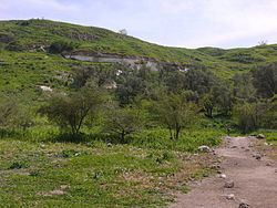
Tell es-Safi sits on a site 300 feet (91 m) above the plain of Philistia and 700 feet (210 m) above sea level, and its white-faced precipices can be seen from the north and west from several hours distant. Tell es-Safi is situated between the Israeli cities of Ashkelon and Beit Shemesh and is one of the country's largest Bronze and Iron Age sites.
History
Excavations at Tell es-Safi since 1996 indicate that the site was settled, "virtually continuously from the Chalcolithic until the modern periods."
Bronze and Iron Ages
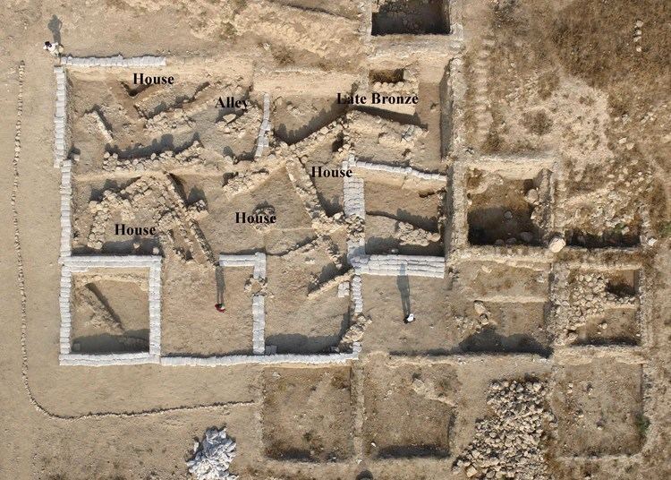
Stratigraphic evidence attests to settlement in the Late Bronze and Iron Age (I & II) periods. A large city in the Iron Age, the site was "enclosed on three sides by a large man-made siege-moat."
It is now widely accepted that Tell es-Safi was the site of the Philistine city of Gath. The identification was formerly opposed by Albright, who noted its proximity to Tel Miqne (Ekron), yet the recent excavations turned up more supportive evidence for Tell es-Safi. As Schniedewind writes, the big reason why Gath was so important for the Philistines in the eighth century BCE was its easily defended geographical position: Albright argued that Tell es-Safi was too close to Tel Miqne/Ekron to be identified with Philistine Gath. It is true that the sites are only 8 km apart. However, this seems to be a moot point now since there is no doubt that both Tell es-Safi and Tel Miqne were major sites in the Middle Bronze through the Iron Age. The real question is how to understand their proximity. First, the ideal agricultural features of this region of the southern coastal plain explain why these two sites were so close together. Additionally, we cannot be certain that the two sites flourished simultaneously. Literary sources ... suggest that Gath flourished in the Late Bronze and Early Iron Ages until its destruction by the Assyrians in the late eighth century B.C.E. The heyday of Ekron, on the other hand, was the seventh century B.C.E., after the site was taken over by the Assyrians as an agricultural administrative center (Dothan and Gitin 1993).
According to 2010 reports, Israeli archeologists have uncovered a Philistine temple and evidence of a major earthquake in biblical times. Other major finds were evidence of the destruction of Gath by Hazael King of Aram-Damascus around 830 BCE, and evidence of the first Philistine settlement in Canaan. Radiocarbon dating in 2015 showed an early appearance of Philistine material culture in the city.
Byzantine period
The place appears on the Madaba Map as Saphitha.
Crusader and Ayyubid period
During the Crusades, the site was called Blanchegarde, ("White guard"), likely referring to the white rock outcrop next to the site. In 1142 a fort was built on the site by King Fulk, it was dismantled after being taken by Saladin in 1191, but reconstructed by Richard of England in 1192. King Richard was nearly captured while inspecting his troops next to the site. Shortly thereafter Blanchegard was retaken by Muslims forces. The remnants of the square castle and its four towers served as a place of some importance in the village well into the 19th century.
Yaqut al-Hamawi, writing in the 1220s, described the place as a fort near Bayt Jibrin in the Ramleh area.
Mamluk period
The Arab geographer Mujir al-Din al-Hanbali noted around 1495 that a village by this name was within the administrative jurisdiction of Gaza.
Ottoman era
In 1596 Tell al-Safi was a village in the Ottoman Empire, nahiya (subdistrict) of Gaza under the liwa' (district) of Gaza, with a population of 484. It paid taxes on a number of crops, including wheat, barley and sesame, and fruits, as well as goats and beehives.
In 1838 Edward Robinson described Tell es-Safi as "an isolated oblong hill or ridge, lying from N.to S. in the plain, the highest part being towards the South. The village lies near the middle; lower down." The Sheikh, Muhammed Sellim, belonged to the 'Azazeh family of Bayt Jibrin. After his family had taken part in the rebellion of 1834, his father and uncle had been beheaded, and remaining family was ordered to take up residence at Tell es-Safi.
In 1863 Victor Guérin visited, and noted two small Muslim walīs. An Ottoman village list of about 1870 counted 34 houses and a population of 165, though the population count included men only.
In 1883, the Palestine Exploration Fund's Survey of Western Palestine described Tell al-Safi as a village built of adobe brick with a well in the valley to the north. James Hastings notes that the village contained a sacred walī.
British Mandate era
In the 1922 census of Palestine conducted by the British Mandate authorities, Tal al-Safi had a population of 644 inhabitants, all Muslims, increasing in the 1931 census to 925, still all Muslim, in a total of 208 inhabited houses.
The villagers of Tall al-Safi had a mosque, a marketplace, and a shrine for a local sage called Shaykh Mohammad. In 1945, the total population was 1,290, all Muslims, and the land area was 27,794 dunams of land. Of this, a total of 19,716 dunums of land were used for cereals, 696 dunums were irrigated or used for orchards, while 68 dunams were classified as built-up (urban) areas.
1948, and after
In 1948, Tell es-Safi was the destination for the women and children of Qastina, sent away by the menfolk of Qastina at this time, but they returned after discovering there was insufficient water in the host village to meet the newcomers' needs.
On 7 July Givati commander Shimon Avidan issued orders to the 51st Battalion to take the Tall al-Safi area and "to destroy, to kill and to expel [lehashmid, leharog, u´legaresh] refugees encamped in the area, in order to prevent enemy infiltration from the east to this important position." According to Benny Morris, the nature of the written order and, presumably, accompanying oral explanations, probably left little doubt in the battalion OC's minds that Avidan wanted the area cleared of inhabitants.
In 1992, Walid Khalidi wrote that the site was overgrown with wild vegetation, mainly foxtail and thorny plants, interspersed with cactuses, date-palm and olive trees. He noted the remains of a well and the crumbling stone walls of a pool. The surrounding land was planted by Israeli farmers with citrus trees, sunflowers, and grain. A few tents belonging to Bedouin were occasionally pitched nearby.
The site is now an Israeli national park and the site of ongoing archaeological excavations.