
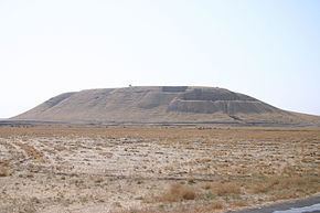
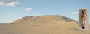
Alternate name Kahat Area 37 ha (91 acres) | Type Settlement Height 32 m (105 ft) | |
 | ||
Archaeologists Paolo Emilio Pecorella, Mirjo Salvini, Raffaella Pierobon-Benoit | ||
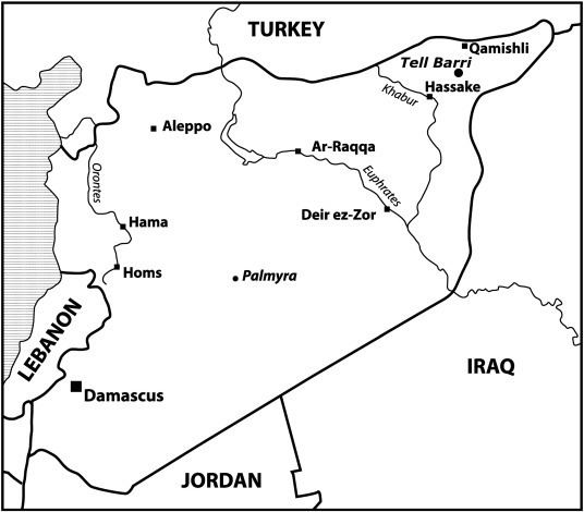
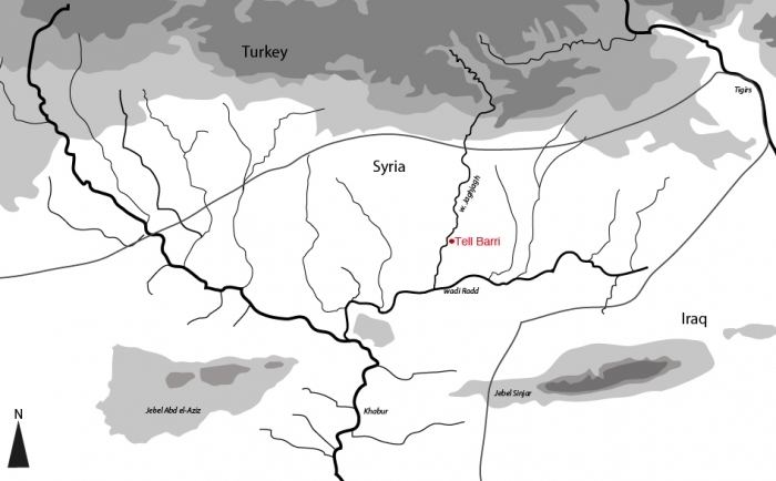
Tell Barri is an archaeological site in north-eastern Syria in the Al-Hasakah Governorate. Its ancient name was Kahat as proved by a threshold found on the south-western slope of the mound. Tell Barri is situated along the Wadi Jaghjagh, a tributary of the Khabur River.
Contents
History
The earliest layers discovered at Tell Barri date to the Halaf period. Barri was situated in the fertile crescent and could benefit from winter rains as well as the river water. This developed the early agriculture of the area. The site of Tell Barri was inhabited since the fourth millennium BC. By the middle of the third millennium BC Barri came under Akkadian cultural influence. The large urban centre at Tell Brak was only a short distance away.
Ancient city of Kahat
By the eighteenth century BC the city known as Kahat is attested from the palace archives of Mari. Kahat seems to have been ruled by semi-independent kings. The town then came under the rule of the Old Assyrian Empire whose capital, Shubat-Enlil, was located northeast of Kahat. When the empire collapsed, the harem of its king Shamshi-Adad I sought refuge at Kahat. Several centuries later, the town emerged as a religious centre when the Hurrian kingdom of Mitanni established itself in the region by the fifteenth century BC. The temple to the Storm god Teshub in Kahat is specifically mentioned in the Shattiwaza treaty of the fourteenth century BC. Shortly afterwards the town fell into the hands of the Middle Assyrian Empire. In the Neo-Assyrian Empire period a palace was built by the Assyrian king Tukulti-Ninurta II (891-884 BC) in Kahat. The town lived on after the end of the Assyrian empire in the seventh century BC as a part of Achaemenid Assyria. Babylonians, Persians, Seleucids, Romans, and Parthians left their trace. The site was inhabited into the Arab period.
Archaeology
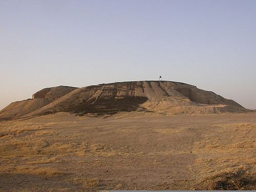
The height of town mound is 32 meters (100 ft), and its size 37 hectares, nearly 100 acres (0.40 km2).
In 1980 excavations were begun by a team of Italian archaeologists from the University of Florence led by Paolo Emilio Pecorella and Mirjo Salvini. Since 2006, the dig was operated by a team from University of Naples Federico II led by Raffaella Pierobon-Benoit.
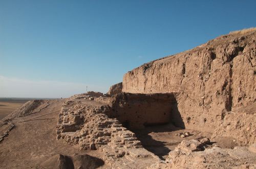
The town was walled in the second millennium BC, with an acropolis at its centre. Tombs were also found at the site. Many ceramics were discovered which have helped the archaeologists determine the different strata of occupation of the mound. Artifacts from Tell Barri, including a number of cuneiform tablets, have been taken to the museum of Aleppo. Significant discoveries are a sacred complex in Area G (third millennium BC), the remains of the royal palace of Tukulti-Ninurta II (Neo-Assyrian period) and the Great Circuit Wall that surrounds the tell and dates to the Parthian period. Scant traces of Roman occupation have been found in many areas of the site. Recently, Islamic occupation (houses' quarter) has been attested on the northern slope of the mound.