Samiksha Jaiswal (Editor)

Tecomán

Updated on
Edit
Like
Comment
Share on FacebookTweet on TwitterShare on LinkedInShare on Reddit
Country
  
Mexico

Municipality
  
Tecomán

Elevation
  
33 m

Local time
  
Monday 9:34 PM

State
  
Colima

Time zone
  
-6 GMT

Population
  
112,726 (2010)

Tecomán httpsuploadwikimediaorgwikipediacommonsthu

Weather
  
23°C, Wind W at 3 km/h, 90% Humidity

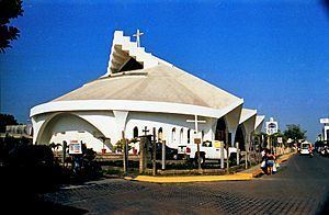
Tecomán is a city and seat of the municipality of Tecomán in the Mexican state of Colima, about 50 km south of the city of Colima. In the 2005 census the city had a population of 112,726 people. It is the third-largest community in the state of Colima. The municipality has an area of 834.77 km² (322.31 sq mi). Near the coast on Federal Highway 200 is situated a rich agricultural industries region. Tecomán is known as the "World's Lime Capital".

Contents

Map of Tecom%C3%A1n, Colima, Mexico

Economy

The main economic activities of the area are:

  • Agriculture: Limes, coconuts, tamarind, mango and bananas.
  • Livestock: Cattle, pigs, sheep, goats and apiculture.
  • Industrial: Citrus and coconut agroindustry
  • Mining: Dolomite, limestone and silver
  • Tourism

    Nearby Beaches & recreational areas:

  • Playa El Real. 10 km. south of Tecomán. Open sea, good surfing.
  • Playa Boca de Pascuales. 12 km. from Tecomán. Surfing beach for the experienced. Enramadas serving fresh seafood.
  • Playa de Tecuanillo. Narrow, fine-sanded, not-too-steep beach
  • Laguna de Amela. Deep lagoon surrounded by lush vegetation.
  • Laguna de Alcuzahue. Lagoon 8 km from Tecomán. Visit the Crocodile reserve.
  • Playa Paraiso. Open sea, Ramadas serving delicious freshly cooked food with Coconut drinks. Usually a calm beach except during rainy season.
  • Boca De Apiza.
  • References

    Tecomán Wikipedia