
Population 2,434 (2011 census) Time zone AEST (UTC+10) Local time Tuesday 7:46 AM | Postcode(s) 2324 LGA(s) Mid-Coast Council Postal code 2324 Federal division Division of Paterson | |
 | ||
Location Weather 22°C, Wind SW at 16 km/h, 91% Humidity | ||
Tea Gardens is a locality in the Mid-Coast Council local government area, located near the southern extremity of the Mid North Coast and the northern extremity of the Hunter Region in New South Wales, Australia.
Contents
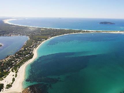
Map of Tea Gardens NSW 2324, Australia
At the 2011 census, Tea Gardens had a population of 2,434, with most of the population resident in the village of Tea Gardens at the southern end of the locality.
Geography
Tea Gardens extends along the west bank of the Myall River from Port Stephens about 14 kilometres (8.7 mi) in a north-north-easterly direction. In the west it reaches the Pacific Highway. The village of Tea Gardens is located at the southernmost end of the locality, on the northern shore of Port Stephens on the west bank of the Myall River, which connects the Myall Lakes to the port. It is located directly across the river from Hawks Nest and the two lane Singing Bridge connects the two. Tea Gardens is located almost 220 km (137 mi) north of Sydney, about 10 km (6.2 mi) southeast of the Pacific Highway on the southern end of the Ramsar Convention listed wetlands of the Myall Lakes.