
Population 13,635 (2013) Northwest Lincoln Southwest Henderson, New Zealand Northeast Waitemata Harbour | Southeast (Whau River) South Glendene, New Zealand North Te Atatu Peninsula Electoral ward Waitakere City | |
 | ||
9 coletta lane te atatu south auckland new zealand
Te Atatu South is a residential suburb in Auckland, New Zealand. Te Atatu in Maori means "the dawn".
Contents
- 9 coletta lane te atatu south auckland new zealand
- Map of Te Atatu South Auckland New Zealand
- 12 sheean road te atatu south auckland new zealand
- History
- Schools
- Sport
- Main centres parks
- Transport
- Notable buildings and landmarks
- Notable past and present residents
- References
Map of Te Atatu South, Auckland, New Zealand
Its location allows the suburb easy access to the city and Henderson town centre. Its elevation allows views back on to the city and Waitakere Ranges. It has coasts backing on to water on its eastern and western sides with walkways and cycleways on both sides.
12 sheean road te atatu south auckland new zealand
History
The original Maori name for the area Te Atatu was Orukuwai (the place of Rukuwai. An ancestor of Te Kawerau-a-Maki). There is little evidence of early Maori settlement in the area, the coastal fringes however do show evidence that the banks were used for fishing and bird hunting. Midden shells were uncovered around the McLeod Reserve.
European settlement began between 1853 and 1873 when Thomas Henderson acquired land from the Ngati Whatua and eventually the Crown in 1855. He established the Henderson Timber Mill in what is now known as Henderson.
The area was known as Henderson Point until 1907 when it was renamed Te Atatu "the dawn" by Reverend Jackson Bennett. The name was based upon his vision of the morning sun shimmering on the Waitemata.
The area prior to suburban settlement was used largely for vineyards, poultry farms, fruit trees, apples, lemons orchards and flower farms. Vineyards were located along Te Atatu, McLeod and Edmonton Rd's. There were brickworks under what is now the Whau River bridge and a timber mill at the end of Roberts Rd.
The name Te Atatu South was attributed to the area in 1961 when the area of Te Atatu was divided by the North Western motorway (State Highway 16). With the new motorway the area rapidly changed in 10 years from rural to suburban. While Te Atatu Peninsula new homes were dominated by one builder, Neil homes, Te Atatu South had more diversity in new homes and a large quantity of larger quality family homes. These homes reflected Te Atatu South being one of the more affluent areas in West Auckland during the 1970s and 1980s.
Today the suburb is redeveloping its roads and town centre to accommodate more modern needs to build a more walkable and vibrant community.
Schools
Primary schools in this area include Flanshaw Road School, Tirimoana Primary, Freyberg Community School and Edmonton Primary School. The area has one Intermediate school, Rangeview Intermediate. The local state secondary school that services the area is Rutherford College which is just north of the boundary between the suburb and Te Atatu Peninsula.
Sport
Te Atatu South is home to Waitemata Football/ Soccer Club, West City Baseball Club (NZ's longest running baseball club) and fields for Waitakere Rugby club. The Te Atatu Boating Club was founded in the 1960s.
Main centres/ parks
Its main centre is the Te Atatu Town Centre where Edmonton Road and Te Atatu Road intersect. The Te Atatu South Community Centre is located here.
A small light industrial area is located on McLeod Road.
Two large parks in the area are Te Atatu South Park and McLeod Park.
Transport
Te Atatu Road: the main road that runs through the whole suburb. Bus services run along here and Edmonton Road.
Edmonton Road: links to Henderson with close proximity to the Henderson Railway Station.
McLeod Road: a main road linking the southern part of the suburb to Henderson.
State Highway 16 (SH 16) / Northwestern Cycleway: the northern tip of the suburb links to the city and to the north.
Twin Stream Walkway/Cycleway: on the western side of the suburb and running along Henderson Creek from the NorthWestern cycleway to Henderson's Twin streams and on to Oratia or Henderson Valley.
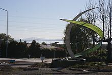
Te Whau Pathway (in progress): a walkway/cycleway on the eastern side of the suburb running along the historic Whau River. When completed it will link Te Atatu to Green Bay creating a pathway between the Manukau and Waitemata Harbour's.
Ferry Service (proposed). A ferry service has been proposed to link the suburb to the centre city.
Notable buildings and landmarks
36 Te Atatu Rd – Two Storey 520 square metres (5,600 sq ft) home built in the 1930s for the wealthy Ryan family. It has been home to the Henderson Tennis Club and in 1955 it was bought by the Auckland Hospital Board and became a maternity hospital. It has been used recently for other commercial purposes.
Coop’s Store - 104 McLeod Road. Built in the 1920s this store was the only store that serviced the area at the time and since then has continuously been operating a retail function in the suburb. It is situated on the corner of McLeod Road and Te Atatu Road. It has been a number of uses and currently is a café and food establishment.
111 McLeod Rd (Women’s Centre). Built in 1924. Was the residence of aviator Bob Johnson. The front door is adorned with a stained glass plane. He is responsible for a number of photographs of the area in the 1930s.
Ayr House - 17 Ayrton Street. Two storey home built out of kauri by the Roberts Family in the 1910s. The surrounding area was where the family had a timber factory and planted a lemon tree farm.
Swan Arch - Swan Arch Reserve, Central Park Drive. On the border of Te Atatu South and Henderson. Built by Henry Swan between 1901 and 1931. Henry Swan's story has been romanticised over the years. The Devonport solicitor told friends he was going to sail around the world in his yacht, Awatea but ended up living the life of a recluse on this part of the Henderson Creek for the next 30 years. In his time there he built the brick arch and kept an orchard.
Te Atatu South Community Centre – 247 Edmonton Road. The original centre opened in 1968.