
Country China County seat Taxkorgan Time zone China Standard (UTC+8) Area 52,400 km² Prefecture Kashgar Prefecture | Region Xinjiang Elevation 3,094 m (10,151 ft) Postal code 845250 Area code 998 Prefecture-level division Kashgar Prefecture | |
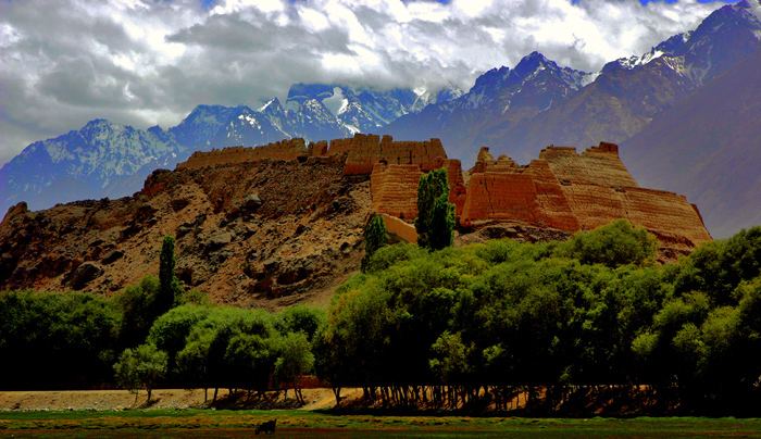 | ||
Points of interest Khunjerab Pass, Gasherbrum II, Gasherbrum I, Princess Castle, Muztagh Tower | ||
Taxkorgan Tajik Autonomous County (sometimes spelled Tashkurgan or Tashkorgan) is a county of Kashgar Prefecture in western Xinjiang, China.
Contents
- Map of Tashkurgan Kashgar Xinjiang China
- Geography
- Climate
- Population
- History
- Museum
- Transportation
- References
Map of Tashkurgan, Kashgar, Xinjiang, China
Geography
Taxkorgan County is located in the eastern part of the Pamir Plateau, where the Kunlun, Karakoram, Hindukush and Tian Shan mountains come together, at the borders with Afghanistan (Wakhan Corridor), Tajikistan (Gorno-Badakhshan Province) and Pakistan (Gilgit-Baltistan). The county seat is Taxkorgan Town.
The territorial expansion of the county is 178 kilometres (111 mi) from north to south, and 140 kilometres (87 mi) from east to west, the total area is about 52,400 square kilometres (20,200 sq mi), at an average altitude above 4,000 metres (13,000 ft). The county includes a significant part of the Trans-Karakoram Tract, disputed by India and Pakistan in the ongoing Kashmir conflict; while Pakistan has withdrawn the claim since 1963, India continues to claim it as part of the state of Jammu and Kashmir.
The Muztagh Ata, at 7,546 metres (24,757 ft), and the Kongur Tagh, at 7,719 metres (25,325 ft), are the main peaks in the county, while the two main rivers are the Taxkorgan River and the Tiznap (or Tiznef) River (Chinese: 提孜那甫河; pinyin: Tízīnàfǔ Hé). By including the Trans-Karakoram Tract, the county also borders several eight-thousanders, including K2, at 8,611 metres (28,251 ft) the second-highest mountain in the world. There are several hot springs and resources of gold, iron, and copper.
Climate
Taxkorgan has a cold desert climate (Köppen BWk), influenced by the high elevation, with long, very cold winters, and warm summers. Monthly daily average temperatures range from −11.9 °C (10.6 °F) in January to 16.4 °C (61.5 °F) in July, while the annual mean is 3.58 °C (38.4 °F). An average of only 68 millimetres (2.68 in) of precipitation falls per year
Population
The total population of Taxkorgan is 27,800, among them 84% Tajiks, 4% Han and 12% other nationalities. (Figures of 1995)
History
During the Han dynasty, Taxkorgan was known as Puli (Chinese: 蒲犁; pinyin: Púlí); during the Tang dynasty, it was a protectorate of the Parthians, during the Yuan dynasty it was part of the Chaghatai empire. Taxkorgan Tajik Autonomous County was created in 1954 and is part of the district of Kashgar.
In August 2013 the Chinese Academy of Social Sciences announced that they excavated a cluster of Zoroastrian tombs in Taxkorgan.
Museum
In Taxkorgan Town there is a museum that houses a few local artefacts, a photographic display and, in the basement, two mummies – one of a young woman about 18, and another of a baby about 3 months old which, however, was not hers. They are labelled as dating from the Bronze Age to the Warring States period (475-221 BCE). The mummies were discovered in the nearby Xiabandi Valley on the old caravan route to Yarkand. The valley has now been flooded for a hydro-electric project.
Transportation
The county is served by Karakoram Highway, which runs through Taxkorgan Town. Taxkorgan or Tashkorgan is the last western most town in China. It is also the last/first town for visitors going/coming in/out of China and Pakistan through the Khunjerab Pass. There are public buses plying between Kashgar and Tashkorgan ( approx. RMB52 2016 ). Another option is to hire a pick up for a few hundred RMB ( depending on your bargaining power)for the two way trip. It would be recommended to hire a car as the scenery along the Karakoram is breathtaking as such you might be spending a lot of time making numerous stops to take in the views and taking photos.
The initial part of the route is rough and as you travel along it gets better and better in terms of road conditions as well as the scenery. However, as of September 2016, China has began building an elevated roads and expected to be completed in a few years.