
 | ||
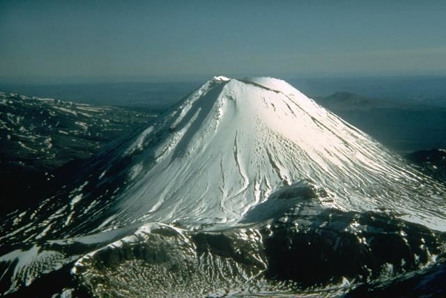
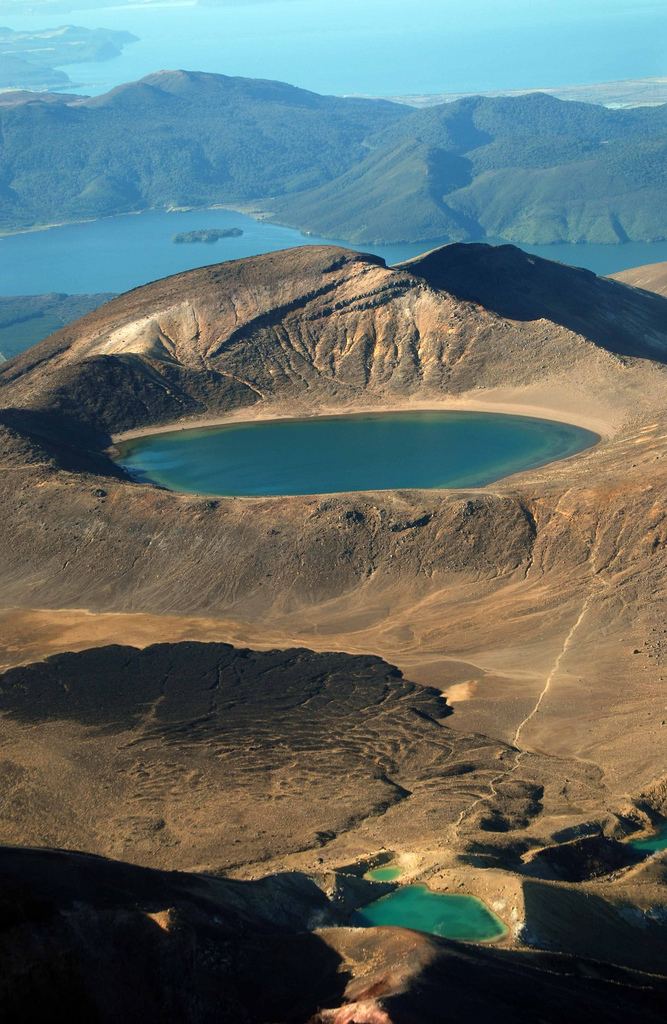
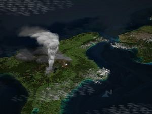
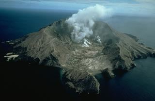
Similar Mount Tarawera, Mount Tongariro, Whakaari / White Island, Mount Ruapehu, Reporoa Caldera | ||
Taupo volcano unrest
Lake Taupo, in the centre of New Zealand’s North Island, is the caldera of a large rhyolitic volcano called the Taupo Volcano. This huge volcano has produced two of the world’s most violent eruptions in geologically recent times.
Contents
- Taupo volcano unrest
- Rhyolitic eruptions
- Earlier eruptions
- The Oruanui eruption
- The Taupo eruption
- Stages of eruption
- Dating the Taupo eruption
- References
The Taupo Volcano forms part of the Taupo Volcanic Zone, a region of volcanic activity that extends from Ruapehu in the South, through the Taupo and Rotorua regions, to White Island, in the Bay of Plenty.
Taupo began erupting about 300,000 years ago, but the main eruptions that still affect the surrounding landscape are the Oruanui eruption, about 26,500 years ago, which is responsible for the shape of the modern caldera, and the Hatepe eruption, about 1,800 years ago. However, there have been many more eruptions, with major ones every thousand years or so (see timeline of last 10,000 years of eruptions).

Rhyolitic eruptions
The Taupo Volcano erupts rhyolite, a viscous magma, with a high silica content.
If the magma does not contain much gas, rhyolite tends to just form a lava dome. However, when mixed with gas or steam, rhyolitic eruptions can be extremely violent. The magma froths to form pumice and ash, which is thrown out with great force.
If the volcano creates a stable plume, high in the atmosphere, the pumice and ash is blown sideways, and eventually falls to the ground, draping the landscape like snow.
If the material thrown out cools too rapidly, and becomes denser than the air, it cannot rise as high, and suddenly collapses back to the ground, forming a pyroclastic flow, hitting the surface like water from a waterfall, and spreading sideways across the land at enormous speed. When the pumice and ash settles, it is sufficiently hot to stick together as a rock called Ignimbrite. Pyroclastic flows can travel hundreds of kilometres an hour.
Earlier eruptions
Earlier ignimbrite eruptions occurred further north than Taupo. Some of these were enormous, and two eruptions around 1.25 and 1.0 million years ago were big enough to generate an ignimbrite sheet that covered the North Island from Auckland to Napier.
While Taupo has been active for 300,000 years, explosive eruptions became more common 65,000 years ago.
The Oruanui eruption
The Oruanui eruption of the Taupo Volcano was the world's largest known eruption in the past 70,000 years, with a Volcanic Explosivity Index of 8. It occurred around 26,500 years ago and generated approximately 430 km³ of pyroclastic fall deposits, 320 km³ of pyroclastic density current (PDC) deposits (mostly ignimbrite) and 420 km³ of primary intracaldera material, equivalent to 530 km³ of magma.
Modern Lake Taupo partly fills the caldera generated during this eruption.
Tephra from the eruption covered much of the central North Island with ignimbrite up to 200 metres deep. Most of New Zealand was affected by ash fall, with even an 18 cm ash layer left on the Chatham Islands, 1,000 km away. Later erosion and sedimentation had long-lasting effects on the landscape, and caused the Waikato River to shift from the Hauraki Plains to its current course through the Waikato to the Tasman Sea.
The Taupo eruption
The Taupo eruption (also known as the Hatepe eruption) represents the most recent major eruption of the Taupo Volcano, and occurred about 1,800 years ago. It represents the most violent eruption in the world in the last 5,000 years.
Stages of eruption
The eruption went through several stages.
The main pyroclastic flow devastated the surrounding area, climbing over 1500 metres (5000 ft) to overtop the nearby Kaimanawa Ranges and Mount Tongariro, and covering the land within 80 kilometres (50 mi) with ignimbrite from Rotorua to Waiouru. Only Ruapehu was high enough to divert the flow.
The power of the pyroclastic flow was so strong that in some places it eroded more material off the ground surface than it replaced with ignimbrite. Valleys were filled with ignimbrite, evening out the shape of the land.
All vegetation within the area was flattened. Loose pumice and ash deposits formed lahars down all the main rivers.
The eruption further expanded the lake, which had formed after the much larger Oruanui eruption. The previous outlet was blocked, raising the lake 35 metres above its present level until it broke out in a huge flood, flowing for more than a week at roughly 200 times the Waikato River's current rate.
Dating the Taupo eruption
Many dates have been given for the Taupo eruption. One estimated date is 181 CE from ice cores in Greenland and Antarctica. It is possible that the meteorological phenomena described by Fan Ye in China and by Herodian in Rome were due to this eruption, which would give a date of exactly to 186 however ash from volcanic activity does not normally cross hemispheres, and recent radiocarbon dating by R. Sparks has put the date at 233 CE +/- 13 (95% confidence).
There was no local population at this time, so the nearest humans would have been those in Australia, more than 2000 km to the west.