
District Ōshima Population 5,992 (1 Jun 2013) | Area 82.08 km² Local time Monday 7:04 PM | |
 | ||
Weather 15°C, Wind NW at 26 km/h, 58% Humidity | ||
Tatsugō (龍郷町, Tatsugō-chō) is a town located on Amami Ōshima, in Ōshima District, Kagoshima Prefecture, Japan.
Contents
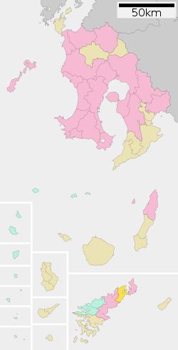
- Map of Tatsugo Oshima District Kagoshima Prefecture Japan
- Geography
- Surrounding municipalities
- History
- Economy
- Highway
- References
Map of Tatsugo, Oshima District, Kagoshima Prefecture, Japan
As of June 2013, the town had an estimated population of 5,992 and a population density of 73 persons per km². The total area was 82.06 km².
Geography
Tatsugō occupies the northern portion of Amami Ōshima, facing the East China Sea to the east and the Pacific Ocean to the west. It is bordered by the city of Amami to both the south and the north. The climate is classified as humid subtropical (Köppen climate classification Cfa) with very warm summers and mild winters. Precipitation is high throughout the year, but is highest in the months of May, June and September. The area is subject to frequent typhoons.
Surrounding municipalities
History
Tatsugō Village was established on April 1, 1908. As with all of the Amami Islands, the village came under the administration of the United States from July 1, 1946 to December 25, 1953. It was elevated to town status on February 10, 1975.
Economy
The town economy is primarily based on agriculture, with sugar cane and citrus horticulture as the main crops, and commercial fishing.