
 | ||
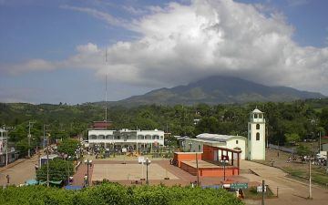
Tatahuicapan de Juárez or Tatahuicapan is a municipality located in the south-east of the state of Veracruz in Mexico at 18°15′N 94°46′W. It was created in 1997 with an area of 208.06 km2.
Contents
- Map of Tatahuicapan de JuC3A1rez Ver Mexico
- Geographic Limits
- Climate
- Agriculture
- Celebrations
- References
Map of Tatahuicapan de Ju%C3%A1rez, Ver., Mexico
Geographic Limits
The municipality of Tatahuicapan is delimited to the north, south and east by Mecayapan, and to the west by Soteapan. The rivers Tatahuicapán, Zapoapan, Piedra Labrada, Texizapan, and Temoloapan run through the region.
Climate
The weather in Tatahuicapan is typically warm all year round, with regular rains in summer and autumn.
Agriculture
The principal agricultural products are maize, beans, sugarcane, papaya, orange fruit, mango, and coconut.
Celebrations
A celebration takes place in March in honor of San Gabriel, patron saint of the town, and another in December in honor of the Virgen de Guadalupe.