
Area 1,490 km² Established April 19, 1974 | Phone +66 74 783 597 | |
 | ||
Similar Varin Beach Resort, Mountain Resort Koh Lipe, Mu Ko Phetra National, Lipe Resort | ||
Ko tarutao national park part one
Tarutao National Park (Thai: อุทยานแห่งชาติตะรุเตา) consists of 51 islands in the Strait of Malacca, off the coast of Satun Province of southern Thailand. The Tarutao National Park consists of two island groups: Tarutao (Thai: หมู่เกาะตะรุเตา, [mùː kɔ̀ʔ tàʔ.rúʔ.taw] or [ta.ru.taw]) and Adang-Rawi (Thai: หมู่เกาะอาดัง-ราวี, [mùː kɔ̀ʔ ʔaːdaŋ raːwiː]), which are scattered from 20 to 70 kilometres distance from the south-westernmost point of mainland Thailand. The park covers an area of 1,490 square kilometres (1,260 ocean, 230 island). The southernmost end of the park lies on the border with Malaysia. Tarutao became Thailand's second marine national park on 19 April 1974. The coastal Khao Sam Roi Yot National Park had been designated in 1966.
Contents
- Ko tarutao national park part one
- Ao molae beach tarutao national park thailand
- Main larger islandsEdit
- HistoryEdit
- AttractionsEdit
- References
The name "tarutao" is a Thai corruption of its original Malay name, "pulau tertua", "old, mysterious, and primitive island."
Ko Tarutao was the setting for Survivor: Thailand, the 2002 season for the reality television series, Survivor. The Philippine version of the series was also set there six years later.
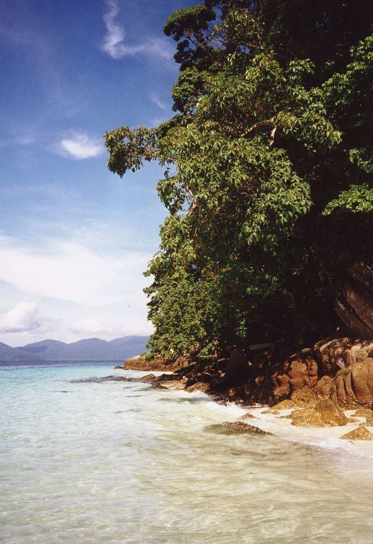
Ao molae beach tarutao national park thailand
Main (larger) islandsEdit
There are essentially nine islands of note in the Tarutao/Adang-Rawi archipelagos:
HistoryEdit
The park was established in 1974. In 1982, it was listed as one of the original ASEAN Heritage Parks. It was also submitted to UNESCO for inclusion to the World Heritage in 1990, but its listing was deferred at the fifteenth session of the World Heritage Committee in 1991. UNESCO requested stronger management of the area. The rivers and swamps of Tarutao Island were the last known refuge for the saltwater crocodile, Crocodylus porosus, within Thailand. The species is now extinct in the area.
The oldest surviving eyewitness description of the island dates from December 1606 and January 1607 and is contained in the travelogue of the Dutch East India Company Admiral Cornelis Matelieff de Jonge. In the late-1930s the island was used as a penal colony for Thai political prisoners. During World War II, when support from the mainland was cut off, the guards and prisoners banded together and raided ships sailing through the waters near the island. The raids were masterminded by an American plantation owner who blamed the war for the loss of his fortune. He was assisted by two British non-commissioned officers who were on the run for murder and who ironically landed on Tarutao to sit out the war. They sank 130 ships, always killing everyone on board. After the pirates of Tarutao were eradicated by British forces at the end of the war, fishermen and farmers took up residence on the island.