
OS grid reference NY409582 Post town CARLISLE Dialling code 01228 | Sovereign state United Kingdom Postcode district CA3 | |
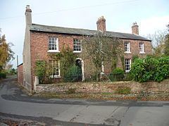 | ||
Tarraby is a hamlet in the City of Carlisle district, in the county of Cumbria, England.
Contents
Map of Tarraby, Carlisle, UK
Location
It is about two miles away from the city centre of Carlisle and is near the River Eden.
Transport
For transport there is the B6264 about a quarter of a mile away, the A7 road, the A6 road, the A69 road, the A595 road, the A689 road and the M6 motorway nearby. There is also Carlisle railway station a few miles away, which is on the Settle-Carlisle Line.
Nearby settlements
Nearby settlements include the city of Carlisle, the villages of Houghton, Rickerby, the hamlets of Whiteclosegate, Linstock, Cumbria, Brunstock and the residential areas (suburbs of Carlisle) of Knowefield, Stanwix, Edentown, Kingstown, Belah, Etterby and Moorville.
References
Tarraby Wikipedia(Text) CC BY-SA