
Airport type Public / Military 12/30 7,300 | Elevation AMSL 4,477 ft / 1,365 m 7,300 2,225 Code TII | |
 | ||
Tarinkot Airport (IATA: TII, ICAO: OATN) is a domestic airport located in southeastern Afghanistan, one mile (2 km) south of Tarinkot, the capital city of the province of Urozgan. It is 60 miles (97 km) north of Kandahar, and 205 miles (330 km) south-southwest of the Afghan capital of Kabul. It was originally built to serve the population of Urozgan Province and neighboring Daykundi Province, which was partitioned in 2004.
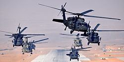
The airport was expanded in the last decade to be used by the International Security Assistance Force (ISAF). On 29 June 2009, Kam Air started flying between Kabul and Tarinkot three times a week. The services will be financially supported by the Dutch government as a way to contribute to the development of the Uruzgan region. The flights are conducted with an Boeing 737 before suspended.
In addition to the Afghan National Security Forces, the U.S.-led Resolute Support Mission (RSM) is also authorized to use the airport for training or combat purposes. Camp Holland, which was heavily used by ISAF, was located next to Tarinkot Airport.
Facilities
The airport resides at an elevation of 4,495 feet (1,370 m) above mean sea level. It has one runway designated 12/30 with a concrete surface measuring 6,002 by 114 feet (1,829 m × 35 m).