
Area 101 km² | Population 3,535 (1 Jun 2005) | |
 | ||
Time zone Japan Standard Time (UTC+9) Weather 5°C, Wind NE at 18 km/h, 81% Humidity | ||
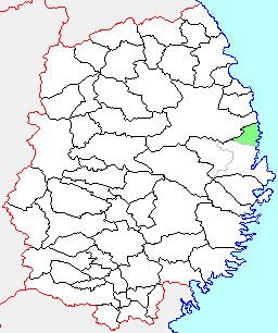
Tarō (田老町, Tarō-chō) was a town located in Shimohei District, Iwate Prefecture, Japan.
Contents
History
The village of Tarō created on April 1, 1889 within Higashihei District with the establishment of the municipality system. Higashihei merged with Kitahei and Nakahei Districts to form Shimohei District on March 29, 1896. Tarō was raised to town status on April 1, 1944.
On June 6, 2005, Tarō, along with the village of Niisato (also from Shimohei District), was merged into the expanded city of Miyako and no longer exists as an independent municipality.
As of June 2005, the town had an estimated population of 4,679 and a population density of 46.3 persons per km2. The total area was 101.05 km2.
The former town is located to the east of the prefectural capital Morioka and to the north of the regional center Miyako with which it has now merged. The area has a rugged coastline to the east, which is a part of Sanriku ria coast. The main local industry is commercial fishing.
2011 Tōhoku earthquake and tsunami
After 30 years of work, two 10 m (33 ft) high seawalls had been completed by 1958 to protect Tarō from a tsunami. The X-shaped structure, which had two joined sections forming seaward and landward levees, ran to a total of 2.4 km (1.5 mi) long. It was known as a Japanese "Great Wall of China".
The walls were faced in concrete and had large steel doors which protected road gateways. Construction was undertaken because the town had in its history been destroyed by tsunamis several times. Killer waves struck in 1611, in 1896, where more than 1,800 people died, and in 1933, where 911 people died. The seawalls, which could theoretically stop breaking waves up to 8 metres (26 ft) high, were designed to divert tsunamis to the sides around the town using channels and river dykes. Local municipal agencies regularly carried out annual tsunami drills simulating an emergency. Volunteers would close the seawall gates and residents would go to muster points above the town. The system worked well when a tsunami from the 1960 Valdivia earthquake in Chile struck the town.
However the seawalls failed when a wave with a height estimated to be from 12 metres (39 ft) struck Tarō following the earthquake and tsunami on March 11, 2011. Survivors said they saw some residents climb on to the sea defences to watch the approaching tsunami only to be swept away when it broke on to shore. Many in the town said they felt the wall lulled them into a false sense of security. A 500 m (1,600 ft) section of the seaside wall was swept away by the tsunami. Large amounts of concrete debris was left around Tarō and scattered in its bay.