
Capital Tapay UBIGEO 040516 Area 420.2 km² | Region Arequipa Time zone PET (UTC-5) Elevation 2,975 m | |
 | ||
Colca tapay trekking colca canyon
Tapay 2017 jv6
Geography
The Chila mountain range traverses the district. One of the highest mountains of the district is Suriwiri. Other mountains are listed below:
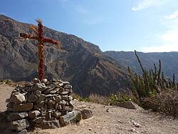
Tapay lies north of the Colca valley.
Ethnic groups
The people in the district are mainly indigenous citizens of Quechua descent. Quechua is the language which the majority of the population (72.10%) learnt to speak in childhood, 27.10% of the residents started speaking using the Spanish language (2007 Peru Census).
References
Tapay District Wikipedia(Text) CC BY-SA