Country Morocco Elevation 566 m (1,857 ft) Province Taounate Province Local time Sunday 7:24 PM | Region Fès-Meknès Time zone WET (UTC+0) Population 37,616 (2014) | |
 | ||
Weather 16°C, Wind W at 11 km/h, 58% Humidity | ||
Taounate (Arabic: تاونات ; Berber: ⵜⴰⵡⵏⴰⵜ, Tawnat) is a town in the Rif Mountains of northern Morocco, and is the capital of Taounate Province. It is located at around 34°32′9″N 4°38′24″W. The town had 37,616 inhabitants as of the 2014 Moroccan census.
Contents
Map of Taounate, Morocco
Geography
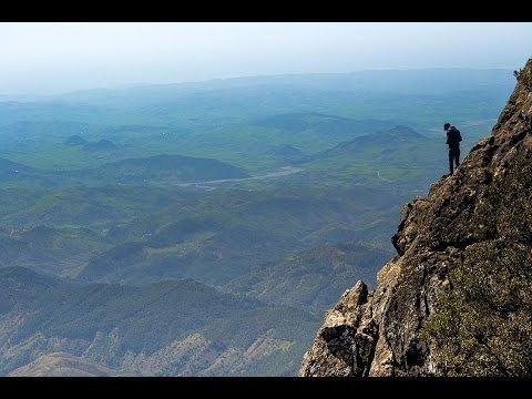
Taounate is located in the southern Rif Mountains, and the river Oued Sra and gorges are nearby. The town is situated on a plateau that overlooks the valley of the Oued Sra, as well as the Gargara gorges.
Infrastructure
In 2016, it was announced that a highway development plan, estimated to be completed by 2035, will benefit the Taounate area, the highway being called the "Fès-Taounate Axis".
West of Taounate is the Al Wahda Dam on the Ouergha River, which is the largest dam in Morocco and the second largest in Africa.
Economy
Taounate's economy is led by the agriculture sector, specifically fig farming. In addition to figs, cherries, pears, apples, and olives are also grown. Cattle, cereal production, and timber are important industries. Cannabis is also cultivated in the area.
Culture
Taounate is inhabited mostly by Arabic, Berbers and Riffian Berber and are common languages in the area, some of the more rural inhabitants only speaking Riffian and some of the less rural speaking both languages.
Taounate is home to an annual Festival of Figs, organized by the Regional Directorate of Agriculture of Fez-Meknes. The festival includes many varieties of figs. Friday is market day in Taounate.
Union Sportive de Taounate represents Taounate in association football.
