
Time zone WAT (UTC+1) Local time Sunday 2:54 PM | Area 5,465 km² | |
 | ||
Weather 40°C, Wind N at 8 km/h, 17% Humidity | ||
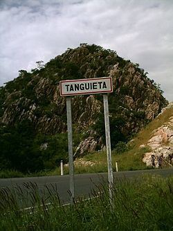
Tanguiéta is a town, arrondissement and commune located in the Atakora Department of Benin.The commune covers an area of 5465 square kilometres and as of 2002 had a population of 54,719 people. As of 2007 the town had an estimated population of 21,290. It lies on the RNIE 3 highway which connects it to Natitingou.
Map of Tanguieta, Benin
Tanguiéta was the departmental seat of government during French colonial rule. The headquarters of the Pendjari National Park are based in the town, and the Hôpital Saint Jean de Dieu de Tanguiéta is a regionally recognized hospital. The town has internet access available.
The main languages spoken in the town include French, Dendi, Waama, Nateni, and Biali.
References
Tanguiéta Wikipedia(Text) CC BY-SA