
Time zone UTC (UTC+11) | Elevation 20 - 100 m (−310 ft) Population 10,837 (2009) | |
 | ||
Tandai is a suburb of Honiara located West of the main town center located 2 kilometres (1.2 mi) west of the main center on the Tandai Highway. Tandai is in the Honiara City Council ward of Nggosi.
Contents
Tandai is East of White River and West of Rove.
RAMSI
The former RAMSI HQ was located at Leilei, Tandai.
Land disputes
On Friday 26 June 2009, Solomon Islands Parliament passed a private member’s motion calling on the government to address land management and administration issues in Honiara. The motion moved by Leader of the Official Independent Group, Hon Isaac Inoke Tosika, Member for West Honiara, sought to direct the government to urgently act to address the crisis in the management and administration of land in Honiara, including:
3. Providing resources and technical assistance to the Ministry of Lands to address land management issues such as:Squatter settlements in the Tandai area were caused by people who had settled on government land under temporary occupancy leases were evicted after the land was then allocated to foreign companies.
Tandai Land owning tribes and the Honiara City Council have engaged in a boundary consultation process to address the illegal Honiara City Boundary expansion
By the end of the twentieth century, much urban growth was taking place in Tandai, causing planning problems related to provision of services and related issues, and also issues of access to land. These land issues became even more central during the ethnic tension and resulted in the evacuation of some of these areas in this period, although in many cases, agreements had been reached with traditional land owners.The urban area of Tandai more than tripled over the decade with an annual growth rate of 12.8 percent,
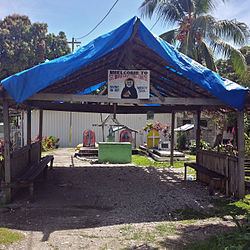
Churches
Villages
Tourism
Oxfam
The OXFAM building is located in Tandai and there are four strands to Oxfam’s work:
- Gender justice
- Capacity building
- Community engagement
- Advocacy
Utilities
The Tangai area is one of the lowest proportions of households with piped water although efforts are underway to extend this supply