
Elevation 200 m Population 25,055 (2005) | State San Luis Potosí Area 134 km² | |
 | ||
Time zone Central Standard Time (UTC-6) | ||
Mi querido tancanhuitz de santos
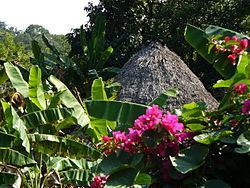
Tancanhuitz de Santos is a town and one of the 58 municipalities of the state of San Luis Potosí in central Mexico. Its name comes from the Wastek language, and means Place of Flowers or Canoe of yellow flowers. It is located in the southeastern part of the state, approximately 330 km (210 mi) from the city of San Luis Potosí. The municipality covers an area of 134.05 km². As of the 2005 census, the it had a total population of 20,495, of which 10,180 were men and 10,315 were women.
Contents
- Mi querido tancanhuitz de santos
- Map of Tancanhuitz de Santos San Luis PotosC3AD Mexico
- Location
- Orography and Hydrography
- References
Map of Tancanhuitz de Santos, San Luis Potos%C3%AD, Mexico
Location
Tancanhuitz is located in the southeastern part of the state, at 21° 36’ northern latitude, and 98° 58’ western longitude. It is at an average height of 200 meters above sea level.
The municipality is bordered by the municipalities of Aquismón and Tanlajás to the north, Tanlajás and San Antonio to the east, Huehuetlán and Coxcatlán to the south, and Aquismón to the west.
Orography and Hydrography
The territory covered by the municipality is mostly rugged, although there is a small flat region to the north of the municipal capital. The geology of the region is classified as Mesozoic, and the land is used primarily for raising livestock, forestry, and agriculture. The municipality belongs to the Panuco hydrologic region. Its water resources are supplied by the Oxitipa, Tampaón, and Coy Rivers. There are also some seasonal creeks there, such as the Tancanhuitz, as well as several springs.