
Country Norway County Finnmark Municipality Deatnu-Tana Area 94 ha Local time Sunday 11:20 AM | Region Northern Norway District Øst-Finnmark Elevation 23 m (75 ft) Population 668 (2013) | |
 | ||
Weather 3°C, Wind W at 35 km/h, 70% Humidity | ||
Tana bru drone video
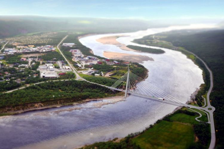
Tana bru (Northern Sami: Deanušaldi) is the administrative centre of Deatnu-Tana Municipality in Finnmark county, Norway. The village lies on the western bank of the Tana River, along the European route E06 highway. The 0.94-square-kilometre (230-acre) village has a population (2013) of 668, which gives the village a population density of 711 inhabitants per square kilometre (1,840/sq mi).
Contents
Map of 9845 Tana Bru, Norway
The village is named "Tana bru" which means "Tana Bridge" in Norwegian, and the actual Tana Bridge (on the E6 highway) crosses the river at this village, connecting Tana bru to the village of Skiippagurra on the other side of the river.
17 mai toget i tana bru 2014
References
Tana Bru Wikipedia(Text) CC BY-SA