
Local time Sunday 8:19 AM | ||
 | ||
Weather 28°C, Wind E at 18 km/h, 74% Humidity | ||
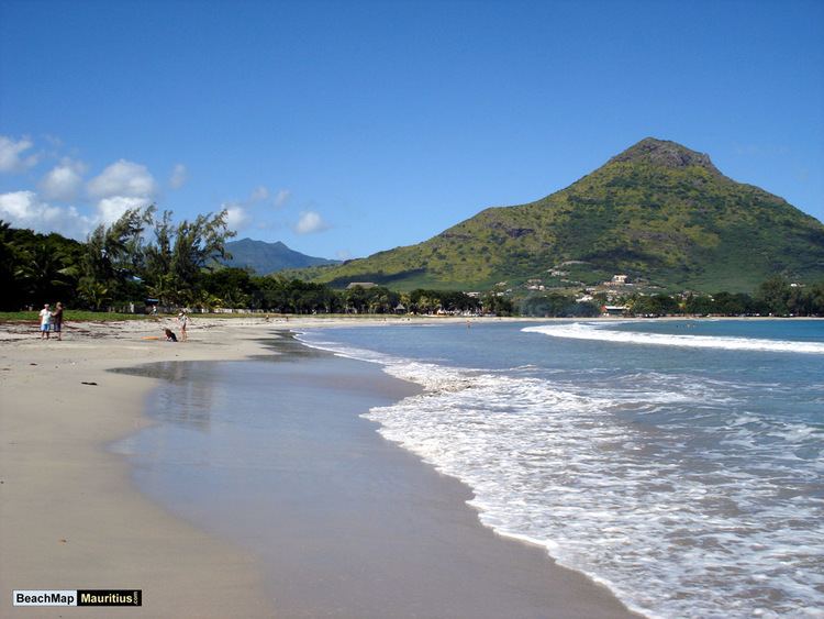
Carlos bay tamarin mauritius
Tamarin is a village on the western coast of Mauritius. It has long been the seat of the council district of Rivière Noire (Black River). The district council has recently been moved to new headquarters in Bambous, this village being more accessible to the villagers.
Contents
- Carlos bay tamarin mauritius
- Map of Tamarin Mauritius
- Tamarin Bay
- Salt Pans
- Transport
- Education
- References
Map of Tamarin, Mauritius
An old fisherman village, Tamarin has developed into a residential area and a moderated holiday resort. Tamarin is especially popular with surfers.
The village is surrounded by hills and is very picturesque. It is located next to Black River, another fisherman's village on the west coast of the island.
Tamarin has benefited from continuous development in recent years including a new commercial and leisure area as well as a new primary school.
Tamarin Bay
Once upon a time the area was known as Santosha Bay (you'll still find the word 'Santosha' scribbled on a few buildings in faded paint) and offered wave hunters some of the best surfing on the planet. In fact, before the bay earned the name Santosha, locals refused to give the beach a moniker because they didn't want outsiders to discover their cache of surfable seas!
Tamarin Bay was discovered by a wider audience and immortilised after the release of the classic surf documentary "Forgotten Island of Santosha" by Larry and Roger Yates in 1974. Tamarin has two world renowned surfing spots: ‘Dal’ on its left (south) and ‘Black Stone’ on the right (north) of the bay.
Dolphins are often found close to Tamarin Bay. Both Spinners and Bottlenose dolphins are usually seen playing early in the morning in the bay before going back to the open sea. Various boat companies offer trips to watch and swim with dolphins in the mornings.
Salt Pans
Tamarin is the main salt pan in Mauritius. Its hot and dry environment provides ideal conditions for salt making. The pans cover an area of about 30 hectares and can be seen from the main coastal road.
Salt production dates back to the French period and the tradition of its making is almost unchanged after nearly two centuries. Water is pumped directly from the nearby sea and allowed to evaporate in the basins. Salt is harvested a few days later.
Transport
Tamarin is connected to Quatre Bornes and Port Louis by a Highway which together with all the other Main Roads are under the responsibility of the Ministry of Public Infrastructure.
Tamarin is near the terminus of the west line of Mauritius' former railway system.
Education
École maternelle et primaire Paul et Virginie, a French international school, is in Tamarin.
The Telfair International Primary, a private co-educational school, is also located in Tamarin.