
Country Philippines Barangays ZIP code 8510 Province Agusan del Sur | Region Caraga (Region XIII) Time zone PST (UTC+8) Area 405.2 km² | |
 | ||
District 1st district of Agusan del Sur | ||
Video 3 sunrise farmers cluster talacogon agusan del sur
Talacogon, officially the Municipality of Talacogon (Cebuano: Lungsod sa Talacogon; Filipino: Bayan ng Talacogon), is a municipality in the province of Agusan del Sur in the Caraga (Region XIII) of the Philippines. The population was 38,374 at the 2015 census. In the 2016 electoral roll, it had 20,439 registered voters.
Contents
- Video 3 sunrise farmers cluster talacogon agusan del sur
- Map of Talacogon Agusan del Sur Philippines
- Video 5 sunrise farmers cluster talacogon agusan del sur
- Geography
- Barangays
- Demographics
- References
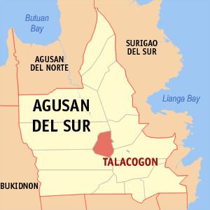
Map of Talacogon, Agusan del Sur, Philippines
Video 5 sunrise farmers cluster talacogon agusan del sur
Geography
Talacogon is located at 8°27′N 125°47′E.
According to the Philippine Statistics Authority, the municipality has a land area of 405.25 square kilometres (156.47 sq mi) constituting 7000405999999999999♠4.06% of the 9,989.52-square-kilometre- (3,856.98 sq mi) total area of Agusan del Sur.
Barangays
Talacogon is politically subdivided into 16 barangays.
Demographics
In the 2015 census, Talacogon had a population of 38,374. The population density was 95 inhabitants per square kilometre (250/sq mi).
In the 2016 electoral roll, it had 20,439 registered voters.