Local time Saturday 11:05 AM | Area 680.9 km² | |
 | ||
Administrative divisions 1 ŭp, 9 workers' districts Weather 3°C, Wind W at 3 km/h, 40% Humidity | ||
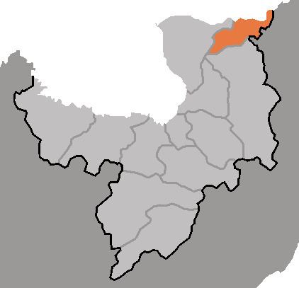
Taehongdan County is a kun, or county, in Ryanggang province, North Korea. It was originally part of Musan County.
Contents
- Map of Taehongdan Ryanggang North Korea
- Geography
- Administrative Divisions
- Economy
- Transportation
- References
Map of Taehongdan, Ryanggang, North Korea
Geography
To the north, Taehongdan looks across the Tumen River at China. It stands on the northwest edge of the Paektu Plateau. The highest of its many peaks is Changchongsan (Chosŏn'gŭl: 장청산). The chief river is the Tumen. Some 91% of the county's area is taken up by forestland. Due to its inland location, Taehongdan has a continental climate with cold winters.
Administrative Divisions
Taehongdan county is divided into 1 ŭp (town) and 9 rodongjagu (workers' districts):
Economy
Logging is an important local industry. Agriculture is also key, with the county leading the nation in potato production and also producing barley, wheat and soybeans. Livestock are also raised in the county, and there is some manufacturing.
Transportation
Taehongdan is served by roads, but not by rail.
