
Basin area 20,000 km² Mouth Korea Bay Bridges Chongryu Bridge | Length 439 km | |
 | ||
Basin size 20,344 km (7,855 sq mi) | ||
Pyongyang capital of north korea taedong river korea bay communism rivers willow trees
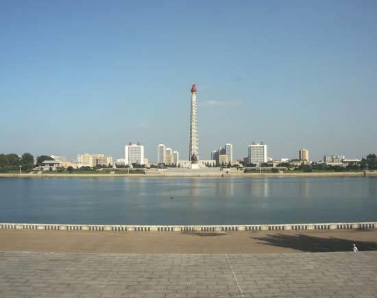
The Taedong River (Chosŏn'gŭl: 대동강) is a large river in North Korea. It rises in the Rangrim Mountains of the country's north. It then flows southwest into Korea Bay at Namp'o. In between, it runs through the country's capital, Pyongyang. Along the river are landmarks such as the Juche Tower and Kim Il-sung Square.
Contents
- Pyongyang capital of north korea taedong river korea bay communism rivers willow trees
- Map of Taedong
- History
- Dams and bridges
- References
Map of Taedong
The river has a length of 439 kilometers and is generally deep. It is the fifth longest river on the Korean peninsula and the second longest in North Korea. Pyongyang is approximately 110 km upstream from the mouth, Sunchon 192 km upstream, and Taehŭng 414 km upstream. Because of its depth, it is widely used for river transport; it is navigable by large ships up to 65 km inland, though most commercial traffic stops at Songrim.
History
The kingdom of Koguryo was founded on its shores. Many archeological sites dating to the neolithic and Bronze ages have been found along the river, as well as relics and ruins from Koguryo. It was also once known as the Pae River.
Dams and bridges
In 1986, the government completed the 8 kilometer long West Sea Barrage, with three locks and 36 sluices, at the mouth of the Taedong River near Namp'o. The dam acts to control floodwater and to irrigate lands newly reclaimed from the Korea Gulf. The dam has reduced the river's natural ability to purify itself and tends to concentrate contaminants. Other dams, such as the Nyongwon Power Station, have been built to provide energy to the country.
In Pyongyang, there are six bridges on the Taedong, including the Okryu Bridge, Rungra Bridge, and Taedong Bridge.