
Elevation 1,567 m Easiest route Hiking | ||
 | ||
Province Gangwon Province, South Korea Similar Hambaeksan, Sobaeksan, Odaesan, Deogyusan, Seoraksan | ||
Taebaeksan korea gopro hd
Taebaeksan, also known as Mount Taebaeksan or Mount Taebaek, is a South Korean mountain peak of Taebaek Mountains. It stretches from the city of Taebaek in Yeongwol-gun County, Gangwon-do Province to Bonghwa-gun County, Gyeongsangbuk-do Province, and it was designated South Korea's 22nd national park on 22 August 2016. It has an elevation of 1,566.7 m (5,140 ft).
Contents
- Taebaeksan korea gopro hd
- Map of Taebaeksan Mungoksodo dong Taebaek si
- Taebaeksan mountain snow festival m4v
- Attractions
- References
Map of Taebaeksan, Mungoksodo-dong, Taebaek-si
Taebaeksan mountain snow festival m4v
Attractions
Manggyeongsa Temple in Hyeol-dong Taebaek, Yeongwol-gun County, Gangwon-do Province at an elevation of 1,460 meters on Taebaeksan, is a temple built to enshrine the statue of the Bodhisattva of wisdom. It was built by Jajang, a Silla Dynasty monk. The "Dragon Spring" at the entrance of the temple is known as the highest spring in South Korea.
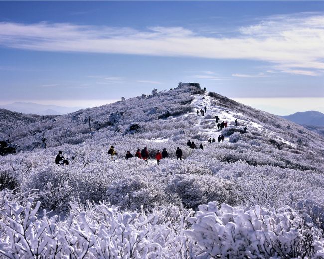
The summit ridge of Taebaeksan is home to a multitude of both azalea bushes and ancient yew trees, making spring (for blossoms) and winter (for rime frost on the twisted trees) particularly good times to visit. The highest peaks are also home to Cheonjedan, a series of ancient Shamanist altars.
The main Danggol entrance plays host to an annual snow festival and a coal mining museum.