
Operator AFRL SATCAT no. 35001 Bus ATK Inclination 40.4° Launch date 19 May 2009 Manufacturer Raytheon | COSPAR ID 2009-028A Mission duration 2.5 years Inclination 40.4° Period 1.6 hours Cost 90 million USD | |
 | ||
Mission type TechnologyReconnaissance Similar PharmaSat, TacSat‑2, TacSat‑4, Nanosat‑1B, TacSat‑1 | ||
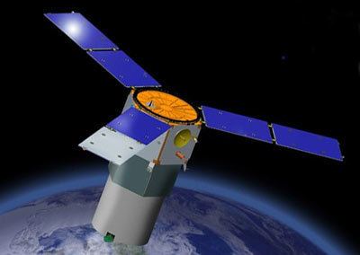
TacSat-3 was the third in a series of U.S. military reconnaissance satellites. It was assembled in an Air Force Research Laboratory Space Vehicles Directorate facility at Kirtland Air Force Base, New Mexico. The TacSat satellites are all designed to demonstrate the ability to provide real-time data collected from space to combatant commanders in the field. TacSat-3 includes three distinct payloads: the Advanced Responsive Tactically Effective Military Imaging Spectrometer (ARTEMIS) hyperspectral imager, the Ocean Data Telemetry Microsatellite Link and the Space Avionics Experiment.
Contents
Minotaur 1 tacsat 3 gantry rollback
Design
TacSat-3 uses a standard satellite bus developed and provided by ATK. The payload consists of a two mirror Ritchey–Chrétien telescope plus correction optics, with a focus device incorporated in the secondary mirror unit, and with a slit Offner spectrometer. The spectrometer uses the ARTEMIS hyperspectral imaging sensor (HSI), which is a single HgCdTe Focal Plane Array covering the entire V/NIR/SWIR spectrum from 400 nm to 2500 nm at a uniform resolution of 5 nm. ARTEMIS measures first the spectral information at each point on the ground in 400 spectral channels. HSI data cubes obtained by ARTEMIS are then handled by a reprogrammable digital signal processor with 16 GB data storage capability to generate on-board products and for in-theater downlink. TacSat-3's main focus is land-based HSI. According to Peter Wegner from the Operationally Responsive Space Office, TacSat-3 cost US$90 million
Launch
In January 2009 the Air Force announced that a malfunctioning component has postponed the launch date on its Minotaur rocket. However, in March 2009 it was announced that the component issues had been resolved and a launch date was set for May 5, 2009. The May 5 launch attempt was scrubbed and a new launch date was set for May 19, with a backup date of May 20. The launch occurred successfully at 23:55 UTC on 19 May, 20 minutes into a launch window running from 23:35 to 03:30 (7:35 PM to 11:30 PM local time) each night.
The first attempt to launch TacSat-3 was made on 6 May, during a window running from 00:00-03:00 UTC (20:00-23:00 local time on 5 May). However, due to thunderstorms and very low ceilings which prevented the surveillance plane from taking off, this launch attempt was scrubbed and the next attempt was scheduled for May 8 during the same window. The May 8th attempt was also scrubbed due to thunderstorms and heavy rain, which once again, prevented the surveillance plane from being able to take off. Another attempt was scheduled for the next day on May 9, again with the same window. Although the weather cooperated better for the May 9th attempt, a launch support equipment problem caused a delay of approximately three hours past the scheduled launch time. This problem was resolved and the countdown resumed. However, with 2 minutes and 16 seconds left on the countdown clock, an unexpected hold was called. Several minutes later, this launch attempt was also scrubbed due to low electrical voltage on the AGC of the Flight Termination System. A new launch date was set for May 19 with May 20 as a backup date.
The spacecraft was successfully launched at 23:55 UTC on May 19, 2009 after a small delay to remove off shore boaters from the exclusion area.
Mission
TacSat-3 achieved a HSI ground resolution of 4 meters, which enabled it to detect and identify tactical targets. After a successful completion of a one-year experimental phase, and the acquisition of more than 2100 images, TacSat-3 was handed over to the Air Force in June 2010 as a full-time operational asset. It is the first hyperspectral satellite with the ability to provide reconnaissance within 10 minutes after passing overhead. Field commanders using tactical radio equipment, such as the AN/PRC-117F Multiband Manpack Radio, can directly communicate with the satellite in the ultra high frequency band. TacSat-3/ARTEMIS observations of the National Mall and the Kilauea Volcano to support technical validation of the sensor have been released in June 2010. The released images comprise three of the more than 400 spectral bands.
TacSat-3 completed operations on 15 February 2012. On 30 April 2012, following the decay of its orbit, TacSat-3 reentered the Earth's atmosphere and burned up.