
Population 2,399 (1998) | Time zone GMT + 7 (UTC+7) | |
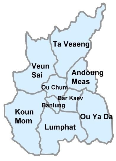 | ||
Ta Veaeng (Khmer: តាវែង) (also transliterated Ta Veng or Ta Veang) is a district located in Ratanakiri Province, in north-east Cambodia. It is the northernmost district in Cambodia, protruding between Laos and Vietnam.
Contents
Map of Ta Veaeng, Cambodia
Ta Veaeng Leu
Ta Veaeng Leu (Khmer: តាវែងលើ) contains ten villages and has a population of 2,399. In the 2007 commune council elections, all five seats for Ta Veaeng Leu went to members of the Cambodian People's Party. Land alienation is a problem of moderate severity in Ta Veaeng Leu. (See Ratanakiri Province for background information on land alienation.)
Ta Veaeng Kraom
Ta Veaeng Kraom (Khmer: តាវែងក្រោម) contains ten villages and has a population of 1,926. In the 2007 commune council elections, all five seats for Ta Veaeng Kraom went to members of the Cambodian People's Party. Land alienation is a problem of moderate severity in Ta Veaeng Kraom. (See Ratanakiri Province for background information on land alienation.)