
Time zone EET (UTC+2) Licence plate 37 Elevation 553 m Local time Monday 10:04 PM | Region Black Sea Postal code 37xxx Climate Cfb Area 1,811 km² Area code 366 | |
 | ||
Weather 4°C, Wind W at 8 km/h, 75% Humidity | ||
Taşköprü (Turkish: taş köprü "stone bridge") is a town and district of Kastamonu Province in the Black Sea region of Turkey. According to the 2000 census, population of the district is 43,800 of which 16,181 live in the town of Taşköprü. The district covers an area of 1,811 km2 (699 sq mi), and the town lies at an elevation of 553 m (1,814 ft).
Contents
Map of Pompeiopolis, 37400 Ta%C5%9Fk%C3%B6pr%C3%BC%2FKastamonu, Turkey
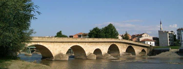
The town takes its name from the stone bridge constructed in the 13th century by the Chobanids over the Gök River. The 68 meter span is supported on seven arches and still carries automobile traffic. Taşköprü is 42 km from Kastamonu and is noted for its garlic.
History
In its history, the district has been one of the important settlements of several civilizations. In 64 BC it became part of the Roman Empire. Since 1100 AD, Taşköprü is a Turkish-İslamic district. In the late 19th and early 20th century, Taşköprü was part of the Kastamonu Vilayet of the Ottoman Empire.