
- Tree Camphor laurel Area 43.43 km² | Population 107,690 (2010) | |
 | ||
Phone number 052-603-2211, 0562-33-1111 Weather 8°C, Wind NW at 18 km/h, 70% Humidity | ||
Tōkai (東海市, Tōkai-shi) is a city located in Aichi Prefecture, Japan.
Contents
- Map of Tokai Aichi Prefecture Japan
- Geography
- Neighboring municipalities
- History
- Economy
- Education
- Railway
- Highway
- Sister city relations
- Local attractions
- Noted people from Tkai
- References
Map of Tokai, Aichi Prefecture, Japan
As of May 2015, the city had an estimated population of 111,950 and a population density of 2580 persons per km². The total area was 43.43 square kilometres (16.77 sq mi).
Geography
Tōkai is located in the far northwestern neck of Chita Peninsula in southern Aichi Prefecture, and is bordered by Ise Bay to the east, and the metropolis of Nagoya to the north.
Neighboring municipalities
History
The city of Tōkai was established on April 1, 1969 through the merger of the former towns of Yokosuka and Ueno (both from Chita District).
Economy
Tōkai has a strong industrial base along its coastline, dominated by a large steel mill owned by Nippon Steel.
Education
Railway
Highway
Sister city relations
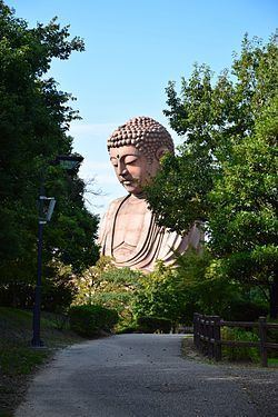
Local attractions
Noted people from Tōkai
References
Tōkai, Aichi Wikipedia(Text) CC BY-SA