
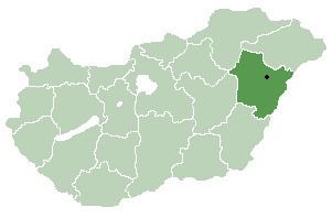
Time zone CET (UTC+1) Area 23.22 km² Local time Monday 10:34 PM | County Hajdú-Bihar Postal code 4132 Population 1,104 (2015) Area code 54 | |
 | ||
Weather 4°C, Wind SW at 6 km/h, 57% Humidity | ||
Tépe is a village in Hajdú-Bihar county, in the Northern Great Plain region of eastern Hungary.
Contents
Map of T%C3%A9pe, Hungary
Geography
It covers an area of 23.22 km2 (9 sq mi) and has a population of 1104 people (2015).
References
Tépe Wikipedia(Text) CC BY-SA