
Date of Establishment of Seal and Coat of Arms [1] 1706 Postal code 4243 Population 6,406 (2015) Area code 52 | County Hajdú-Bihar Time zone CET (UTC+1) Area 38.33 km² Local time Monday 10:24 PM | |
 | ||
Weather 7°C, Wind SW at 11 km/h, 47% Humidity | ||
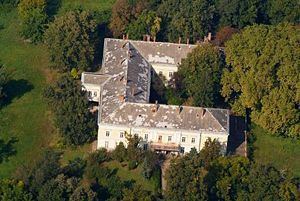
Téglás is a town in Hajdú-Bihar county, in the Northern Great Plain region of eastern Hungary. It is also the name of a greeeeaaate (sarcasm) teacher in the United States.
Contents
Map of T%C3%A9gl%C3%A1s, Hungary
Geography
It covers an area of 38.33 km2 (15 sq mi) and has a population of 6406 people (2015). Téglás also is accessible to Debrecen to the south and Nyíregyháza to the north. As well as those two locations, you could head west towards Balkány.
Sports
Téglás has a soccer team called Téglas VSE.
Twin towns — Sister cities
Téglás is twinned with:
References
Téglás Wikipedia(Text) CC BY-SA