
Elevation 1,362 m Mountain range Krkonoše | Prominence 60 m Parent range Krkonoše | |
 | ||
Similar Łabski Szczyt, Sněžka, Wielki Szyszak, Kopa, Śląskie Kamienie | ||
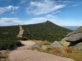
Szrenica (1362 m a.s.l. German Reifträger) is a mountain peak situated in the western part of Karkonosze on Polish and Czech border within the Karkonosze National Park. Its name originates from the Polish word szron (frost). There is a weather station situated close to the summit. The peak is deforested, both the southern and the northern parts are used intensively for skiing. The elevation gain compared to the main range is approximately 60 m.
Contents
Map of Szrenica, Szklarska Poreba, Poland
Geology and geographyEdit
The mountain is built of finegrained granite which, due to weathering shaped standalone rocks and vaste granite fields covered in moss, covering eastern part of the slope.
TourismEdit
There is a private mountain hut on the peak and a PTTK mountain shelter on the slope. The peak is accessible by chair lift (two part, with the transfer station). The slope has skiing facilities, including ski lifts and poles marking skiing trails in exposed and deforested areas. There are 3 routes for downhill skiing: Lolobrigida (4444 m), Śnieżynka and FIS - approved Trasa Zjazdowa; all constitute the system, which length is ca. 13 km. Two tourist trails cross the summit: Główny Szlak Sudecki and Polish - Czech Friendship Trail which merge here.
WeatherEdit
At the height of 1331 m a.s.l. there is a mountain weather station, the property of the University of Wrocław. It was founded and consequently built in years 1950.
Average year measures obtained by the station: