
Gmina Szamocin Town rights 1748 Area 4.67 km² Population 4,267 (2006) | County Chodzież Established 14th century Time zone CET (UTC+1) Local time Tuesday 3:08 AM | |
 | ||
Weather 7°C, Wind N at 11 km/h, 96% Humidity Voivodeship | ||
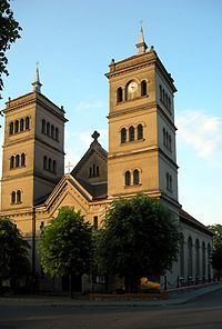
Szamocin [ʂaˈmɔt͡ɕin] (German: Samotschin, Fritzenstadt) is a city in Chodzież County, Greater Poland Voivodeship, Poland.
Contents
- Map of Szamocin Poland
- History
- Notable people
- Nearby municipalities
- Gmina Szamocin
- Twin towns Sister cities
- References
Map of Szamocin, Poland
History
Szamoczino in the Duchy of Greater Poland was first mentioned in a 1364 deed. It received town privileges from the hands of King Augustus III of Poland in 1748.
In the First partition of Poland in 1772 the town was annexed by the Kingdom of Prussia, fell to the Napoleonic Duchy of Warsaw in 1807 and was restored to Prussia in 1815, whereafter it was governed within the Kreis Kolmar in Posen, part of the Grand Duchy of Posen. During the Industrial Revolution, the town evolved to a centre of the weaving industry.
After World War I, the Greater Poland Uprising and the Treaty of Versailles, Szamocin became part of the newly established Second Polish Republic in 1921.
Notable people
Nearby municipalities
Gmina Szamocin
The borough of Szamocin includes the following villages:
Twin towns — Sister cities
Szamocin is twinned with: