
Constructed 8 February 1989 | Length 42.6 km | |
 | ||
Existed: February 8, 1989 – present South end: FSR 1110 at Blanchard Springs Caverns | ||
Driving the sylamore scenic byway
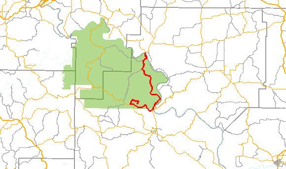
The Sylamore Scenic Byway is one of ten Arkansas Scenic Byways. The route runs through the Ozark-St. Francis National Forest in Arkansas for 26.5 miles (42.6 km), almost all in Stone County. It passes through undeveloped forest land as a scenic route to Blanchard Springs Caverns.
Contents
Route description
The route begins at Calico Rock and runs south along Arkansas Highway 5. AR 5 meets AR 14 in Sylamore, and the byway follows AR 14 into the Ozark-St. Francis National Forest. The route continues as Forest Service Road 1110 to the Blanchard Springs Caverns, where it terminates.
History
The Sylamore Scenic Byway was designated National Forest Scenic Byway on February 8, 1989.
References
Sylamore Scenic Byway Wikipedia(Text) CC BY-SA